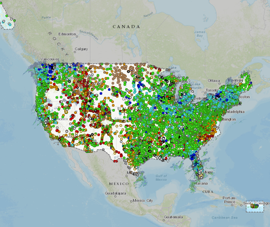
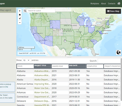
Click on a bubble below to learn more about our work or use the button below to see a list of all projects.
Bubble size indicates when a project was completed. Largest bubbles = most recently completed.
National Water Dashboard
Data Science Applications communicates the products
InFRM Watershed Hydrology Assessment Viewer (WHAV)
Geospatial Science analyzes data
Groundwater Ambient Monitoring and Assessment...
If you get lost, we will find you
Great Salt Lake Hydro Mapper
If it's water, we're studying it
Registry of Scientific Collections (ReSciColl)
Projects located in multiple states, nationwide, and international
National Index of Borehole Information (NIBI)
If you dream it, we can build it
InFRM
Studies data of water use and water availability
Water-Use Data and Research Program
Studies Flood Risk Management (InFRM)
Mississippi River Basin Science Dashboard
Probability of Streamflow Permanence (PROSPER)...
NPS Water Quality Partnership
InFRM Flood Decision Support Toolbox
InFRM Estimate Base Flood Elevation
Edwards Aquifer Urban Hydrology Network