Integrated Hydrology + Data Science
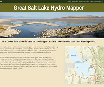
As one of the largest saline lakes in the western hemisphere, the lake and shoreline wetlands are a critical staging area along the North American Pacific Flyway with peak migration shoreline bird counts as high as 1.5 million. To accurately monitor this important resource, the USGS has been collecting water surface elevation data at the Great Salt Lake since 1875 and continuously from October of 1902. As lake levels decline and salinity increases, these changes have implications to the Great Salt Lake ecology and economy the lake supports.
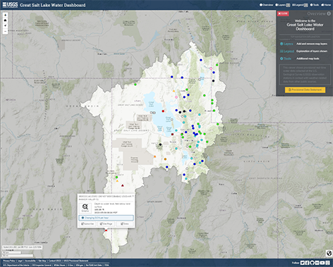
In phase 1 of this application, IHDS developers created a website that provides easy access to
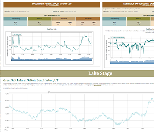
The lake characteristics matrix from the Final Great Salt Lake Comprehensive Management Plan and Record of Decision is available as a series of data visualizations which highlight effects of the current lake level on each characteristic.
Data Analysis
Data Integration
Javascript Development
UX/UI Design
Web Development
AmCharts
Javascript
Leaflet
HTML/CSS
Bootstrap