Integrated Hydrology + Data Science
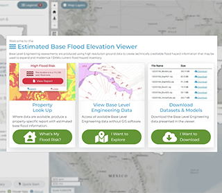
Base Level Engineering is a watershed-wide engineering modeling method that leverages high resolution ground elevation, automated model building techniques, and manual model review to prepare broad and accurate flood risk information for FEMA to assess its current flood hazard inventory. Base Level Engineering prepares flood risk information with scalable engineering, allowing FEMA to both assess its current flood hazard inventory and expand the coverage and availability of flood risk information to communities and individuals interested in reviewing their potential flood risk. InFRM needed a web application that provided centralized and available flood hazard analysis to support floodplain management activities and development review, while increasing risk awareness for individuals.
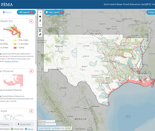
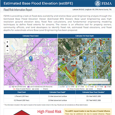
The IHDS development team designed a system to process engineering models and Base Level Engineering datasets and display those models and datasets in an intuitive user interface. The interface, known as the Estimated Base Flood Elevation Viewer, allows
App Development
Data Analysis
Javascript Development
UX/UI Design
Web Development
Google Analytics
Javascript
HTML/CSS
Bootstrap