Integrated Hydrology + Data Science
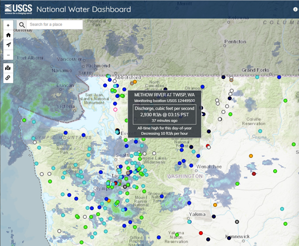
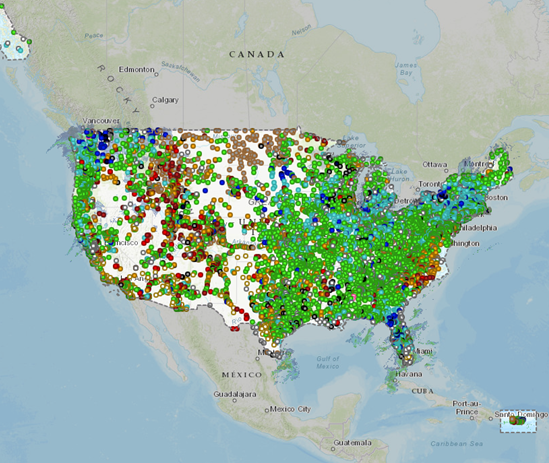
USGS Water Mission Area (WMA) wanted a system that integrates water network operational data from various existing or new data tools for real-time management, resource planning, and situational awareness (including dashboards) of the next generation of water observing network. Specifically, WMA was looking for a web mapping application that presents USGS real-time stream, lake, reservoir, precipitation, well, and water-quality data across the Nation in context with current weather and hazard conditions.
IHDS developers transformed the Texas Water Dashboard into the National Water Dashboard:
Data Integration
Digital Architecture
Science Communication
Web Map Development
ArcGIS Server
Javascript
Leaflet
SQL Server
HTML/CSS