The Grand Canyon region is unique and complex in terms of its geology, hydrology, and ecology. The region contains a wide variety of habitats, which support diverse animals and plants, including threatened and endangered species. Restoring the ecology of the region is a slow process: physical disturbances of habitats in this arid environment do not recover quickly and may require long-term restoration commitments.
The region surrounding the Grand Canyon hosts hundreds, possibly thousands, of unusual geologic features described as "solution-collapse breccia pipes", or simply "breccia pipes". Exploration in the region has shown that a small percentage of the identified breccia pipes contain economic uranium deposits. Breccia pipe deposits have been mined or drilled for uranium ore since the 1980s.
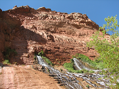
Vaseys Paradise spring issuing from the Redwall Formation in Grand Canyon. Photo courtesy of Don Bills, USGS.
To help meet the future management needs of Federal, State, local, and tribal entities of the Grand Canyon region, the USGS has identified critical scientific studies to better understand the potential effects of uranium and other trace elements on regional water resources, native plants and animals, and cultural and tribal resources. These studies will reduce the unknowns and uncertainties associated with the environmental effects of uranium mining by:
Specific mines are being monitored and assessed during active mining operations and also during pre- and post-mining activities to evaluate potential effects to resources in the region.
In 2012, Secretary of the Interior Ken Salazar closed approximately 1 million acres of Federal land in the Grand Canyon watershed to new mining claims under the 1872 Mining Law until the year 2032 (Record of Decision (PDF)). This action, which is called a "withdrawal" allows time for research on the potential effects of uranium mining on the natural resources in the Grand Canyon and surrounding area.
One key factor in Secretary Salazar's decision to withdraw lands from uranium mining was the limited amount of scientific data that is currently available to assess potential effects, specifically in the terms of groundwater flow paths, radionuclide migration, and biological toxicity pathways.
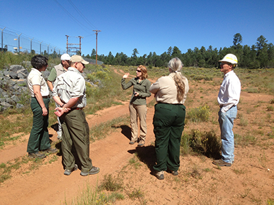
USGS scientists meet with U.S. Forest Service.
Consequently, the USGS developed a 15-year (2012-2027) multidisciplinary science plan (the Grand Canyon Science Plan (GCSP) (PDF)) to address uncertainties about the environmental effects of uranium mining in the region. Following this plan, the USGS research will include:
The Grand Canyon Science Plan (PDF) research objectives are complementary to the goals of Health and Environment research conducted by the Toxic Substances Hydrology and Contaminant Biology programs of the USGS.
The priorities in the original science plan were set by Federal resource-management agencies (Bureau of Land Management, Forest Service, National Park Service, Fish and Wildlife Service). As studies proceed, USGS presents results to these and other stakeholders and designs new studies to address the remaining data gaps concerning the effects of breccia-pipe uranium mining in the Grand Canyon Region that are consistent with USGS science priorities. Some of these new studies may not be specifically described in the original plan due to the evolution of the science direction caused by acquisition and interpretation of data not available when the plan was written.
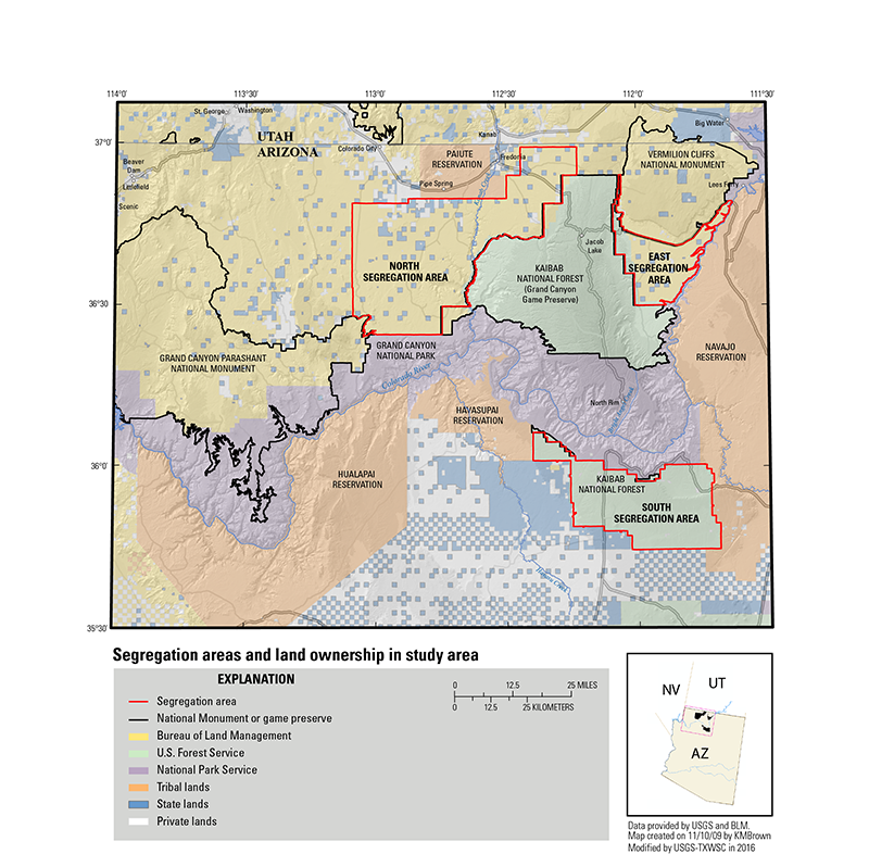
The study area is larger than the proposed areas to be withdrawn from mining development. The study area is bounded on the north by the Arizona-Utah border, on the south by Valle, Arizona, on the east by Lees Ferry, and on the west by Iceberg Canyon at Lake Mead. The proposed mining withdrawal area includes three segregation areas north and south of the Colorado River and encompasses about 1 million acres of Bureau of Land Management, National Forest, State, and private lands; all are contained within the study area.
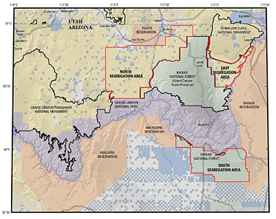
Segregation Areas and land ownership in the Grand Canyon Region study area.
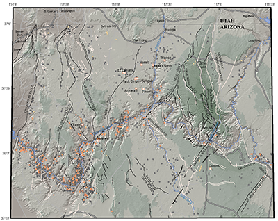
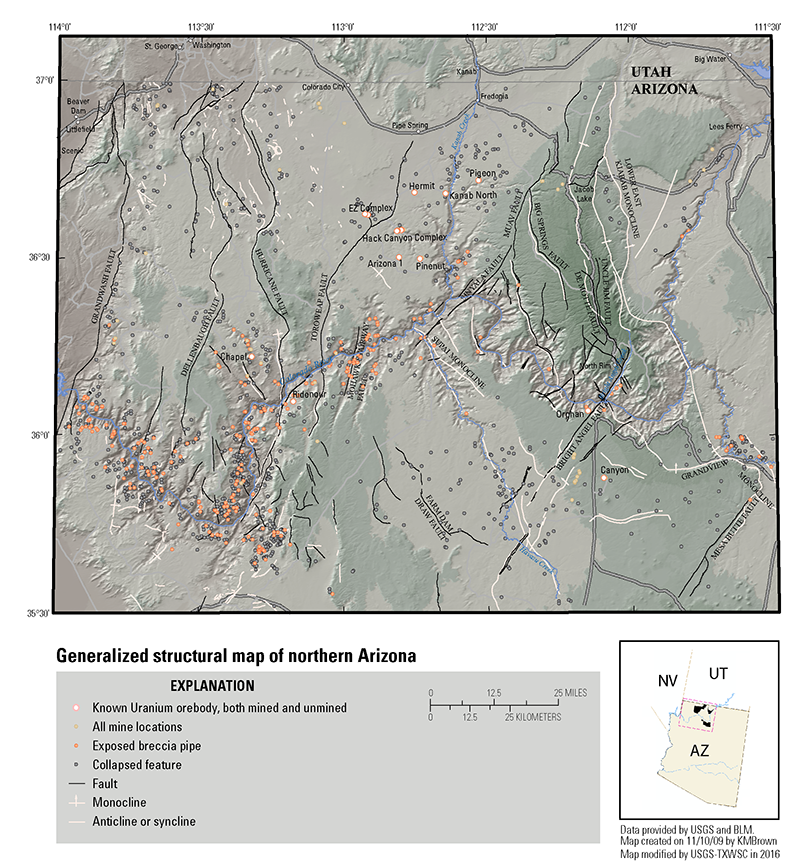
Generalized structural map of northern Arizona.
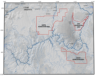
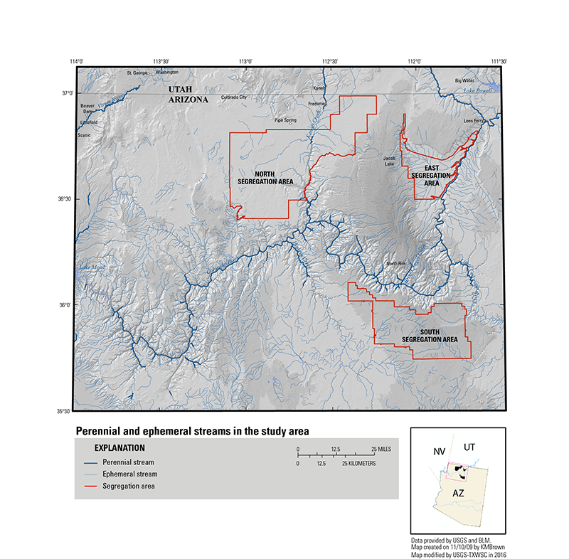
Perennial and ephemeral streams in the study area.