Current Conditions
This page displays discharge data for USGS streamgages located on major surface water inflows to GSL. Lake surface elevations for gages on the north (Saline) and south (Saltair and south side of the railroad causeway) arms of the lake are shown at the bottom of this page. Because most surface water inflows enter the south arm of the lake, its surface elevation is usually higher than the north arm. Currently, water can move through the causeway via an engineered breach and to a lesser extent through the rock-fill causeway material. Gage locations are shown on the map.
Definitions
Data are from the USGS National Water Information System.
Current Daily: Mean daily value. Values are typically from the day before.
Median, Minimum, Maximum: Calculated from daily values for the period of record at each station.
GSL: Great Salt Lake
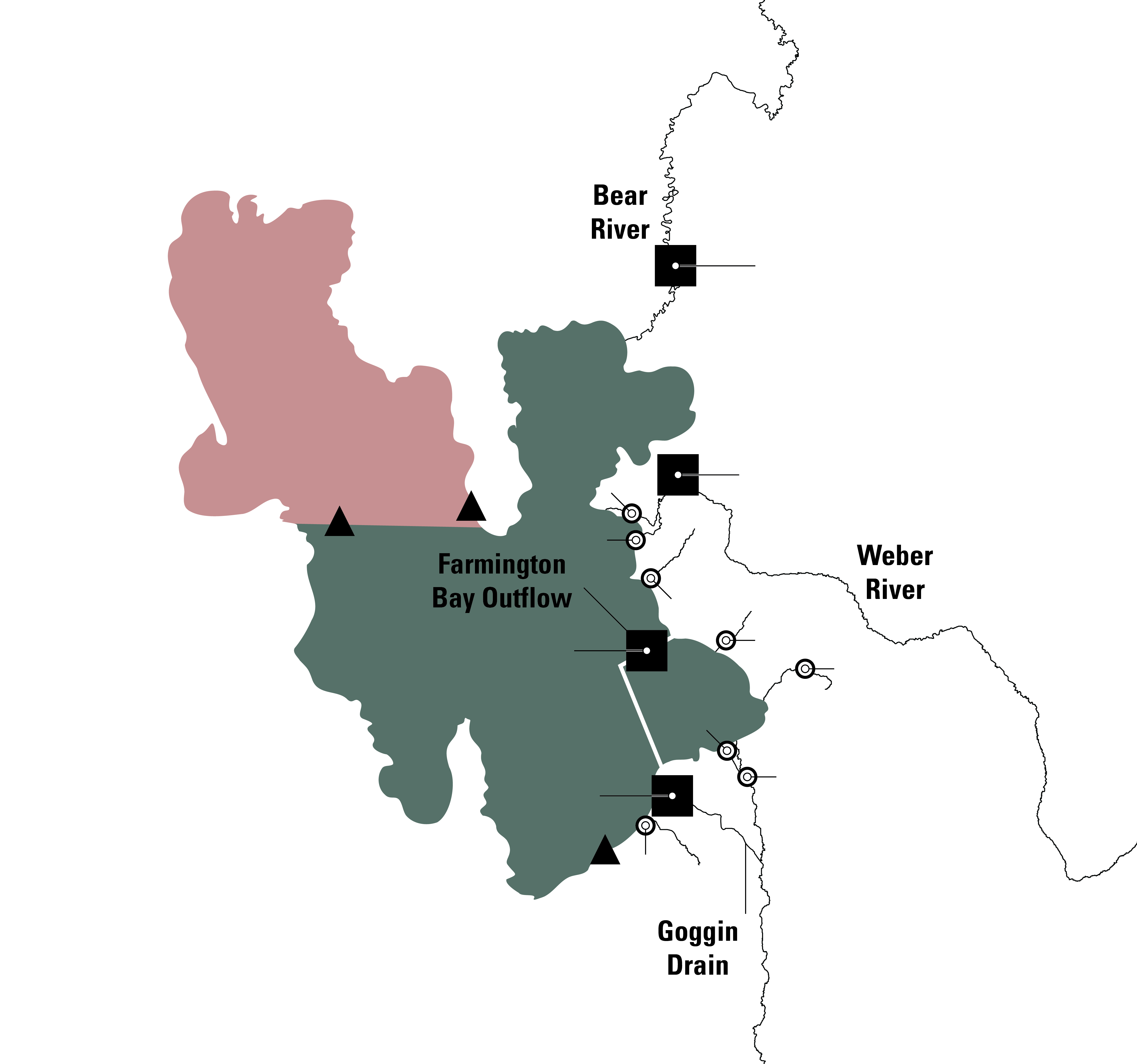
- Major Inflows (cfs)
- Minor Inflows (cfs)
- Lake elevation stations (ft)
Bear River Near Corinne, UT Streamflow
USGS Site ID: 10126000
The Bear River contributes the largest volume of surface water inflow to GSL.
Location: About 8 miles upstream from GSL.
Discharge Record: Dates back to 1949.
Daily Value Data From
Current Daily
ft3/s
Median
ft3/s
Minimum
Year
ft3/s
Maximum
Year
ft3/s
Real-Time Data
Weber River Near Plain City, UT streamflow
USGS Site ID: 10141000
Location: About 4 miles upstream from GSL.
Discharge Record: Dates back to 1907.
Daily Value Data From
Current Daily
ft3/s
Median
ft3/s
Minimum
Year
ft3/s
Maximum
Year
ft3/s
Real-Time Data
Goggin Drain Near Magna, UT streamflow
USGS Site ID: 10172630
Location: About a mile upstream of GSL.
Discharge Record: Dates back to 1963.
Daily Value Data From
Current Daily
ft3/s
Median
ft3/s
Minimum
Year
ft3/s
Maximum
Year
ft3/s
Real-Time Data
Farmington Bay Outflow at Causeway Bridge Streamflow
USGS Site ID: 410401112134801
Gage measures flows moving from Farmington Bay into GSL.
Location: On the causeway bridge near Antelope Island.
Discharge Record: Dates back to 2003.
Daily Value Data From
Current Daily
ft3/s
Median
ft3/s
Minimum
Year
ft3/s
Maximum
Year
ft3/s
Real-Time Data
Wind events can cause flow reversals where water flows from GSL into Farmington Bay. Flows from GSL to Farmington Bay are indicated by negative discharge values.
FARMINGTON BAY MINOR INFLOWS
Jordan River @ Cudahy Ln (10172600) · Kays Creek (10141450) · SLC Sewage Canal (10172625) · Farmington Creek Abv Div (10142000)
Combined real-time plot for key inflows to Farmington Bay of Great Salt Lake.
Real-Time Data
SOUTH ARM MINOR INFLOWS
Lee Creek Nr Magna (10172640) · Howard Slough @ WMA Nr Hooper (10141410) · South Fork Weber R Nr Hooper (10141100) · North Fork Weber R Nr Hooper (10141200)
Combined real-time plot for minor inflows to the South Arm of Great Salt Lake
Real-Time Data