Great Salt Lake Hydro Mapper
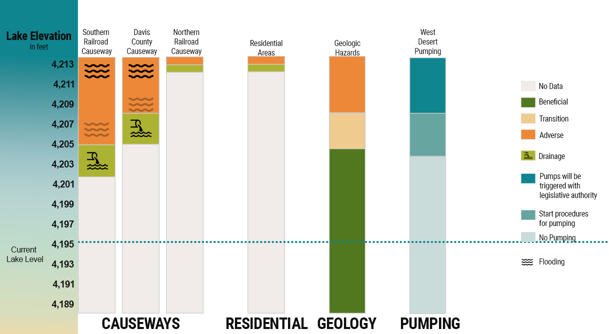
Land use around the Great Salt Lake consists of a mix of residential, commercial, agricultural, recreational, and industrial uses common to population centers. The east side of the lake has the higher concentration and diversity of land uses. Population growth in Weber, Davis, and Salt Lake counties is resulting in the conversion of agricultural land to residential and commercial uses. Residential developments to the east of the Great Salt Lake have been built on elevations as low as 4,217 feet. The 100-year floodplain around the Great Salt Lake generally lies at 4,217 feet, based on surveys completed by U.S. Army Corps of Engineers on the lake’s eastern edges where residential development is most likely to occur. Development below 4,217 feet is discouraged due to flooding risks.
Dikes and causeways in and around the Great Salt Lake serve many purposes. Dikes are used to impound fresh water, impound brine pumped from the lake or trap brine in the lake for brine extraction, and protect facilities from high lake levels. Causeways are also used for transportation facilities along the shore or across the lake.
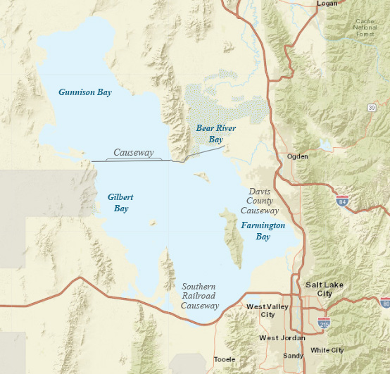
Approximate locations of causeways.
| Place | Effects Begin (feet) |
Overtopping or Flooding Begins (feet) |
|---|---|---|
| Residential Areas | 4,210 | 4,217 |
| I-80 | 4,209 | 4,211 |
| Salt Lake City International Airport | 4,212-4,216 | 4,217 |
| Southern Causeway | 4,205 | |
| Davis County Causeway | 4,205 | 4,208 |
| Northern Railroad Causeway | 4,217 |
Information on this page is from the Final Great Salt Lake Comprehensive Management Plan and Record of Decision.