Great Salt Lake Hydro Mapper
The lake’s extraordinary numbers of waterbirds, magnificent sunsets and vistas, no-sink swimming, trails, wildlife, cultural and range resources, development of Antelope Island, and open space next to a growing metropolitan area provide a fantastic asset for visitors and recreationalists alike.
Common recreational activities include boating (sailing and motorboats), canoeing, kayaking, hiking, biking, wildlife viewing, camping, picnicking, off-highway vehicle use, bird watching, hunting, sightseeing, swimming, and sunbathing.
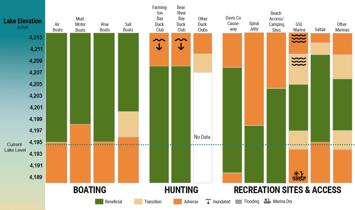
Recreational activities in the Great Salt Lake are best supported by lake levels ranging from 4,198 to 4,204 feet in elevation; levels above or below that range will influence recreational access and opportunity.
Marina access to the lake is significantly reduced at 4,194 feet and effectively eliminated at 4,192 feet restricting motor and sailboat access and opportunities. Canoeists and kayakers can still use the lake at these lower levels. Higher lake levels (4,204 feet and up) can result in temporary or long-term flooding of shoreline marinas and other boating related facilities.

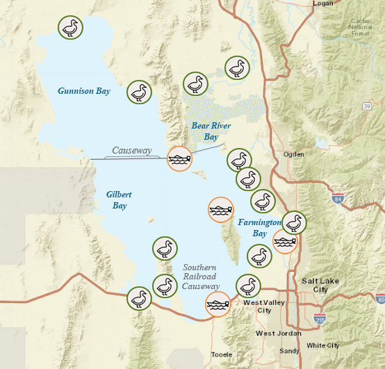
Approximate locations of marinas (boat icon) and recreation sites (bird icon). Icons surrounded by an orange circle indicate current lake level has an adverse effect. Icons surrounded by a green circle indicate lake level has a beneficial effect.

Information on this page is from the Final Great Salt Lake Comprehensive Management Plan and Record of Decision.