Great Salt Lake Hydro Mapper
The wetlands surrounding the Great Salt Lake are of international importance, and they are acknowledged for supporting large populations of migratory birds. As a zone of transition between uplands and the open water of the Great Salt Lake, they also provide other functions. These include flood control, water quality improvement, and biogeochemical processing. Wetlands represent 26% of the 1.37 million acres below the Great Salt Lake boundary, also known as the meander line.
The dynamic process associated with changes in lake level is generally well understood because hydrology and lake level vary from year to year. As lake levels rise, mudflats become shallow open water, whereas freshwater wetlands become increasingly saline or contiguous waters of Great Salt Lake. It is estimated that for every 1-foot increase or decrease in lake level, approximately 44,000 acres of mudflats are inundated or exposed (Aldrich and Paul 2002). As water levels decline, the length of the open water/mudflat interface decreases, reducing the amount of shorebird habitat. During high water, salt is deposited in sediments, which are flushed back into the lake by freshwater tributaries when surface-water levels drop. Due to this exposure, channels with perennial or intermittent flow that are covered during high water now have the potential to support vegetation. Increases and decreases in soil and water salinity drive the establishment of vegetation communities as they adapt to these changing conditions.
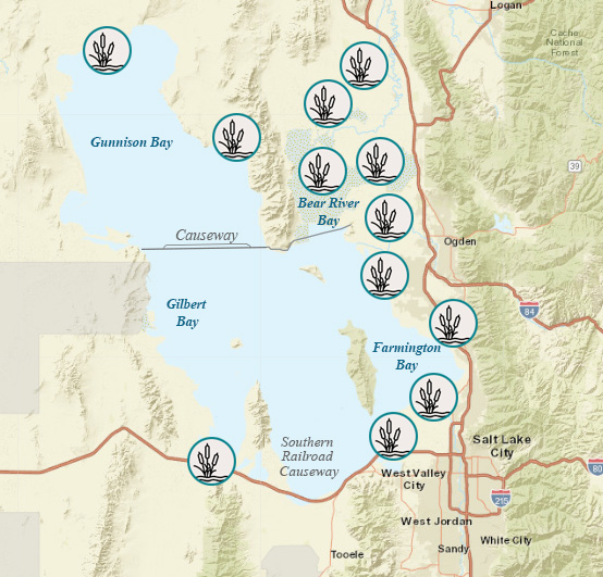
Approximate wetland locations around the Great Salt Lake.
Approximately 360,000 acres of wetlands are below the Great Salt Lake boundary line.
High fringe wetlands are irregularly inundated and contain standing water only when lake levels are high. Low fringe wetlands remain inundated over multiple years and can be considered transitional between open water portions of GSL and regularly exposed high fringe wetlands.
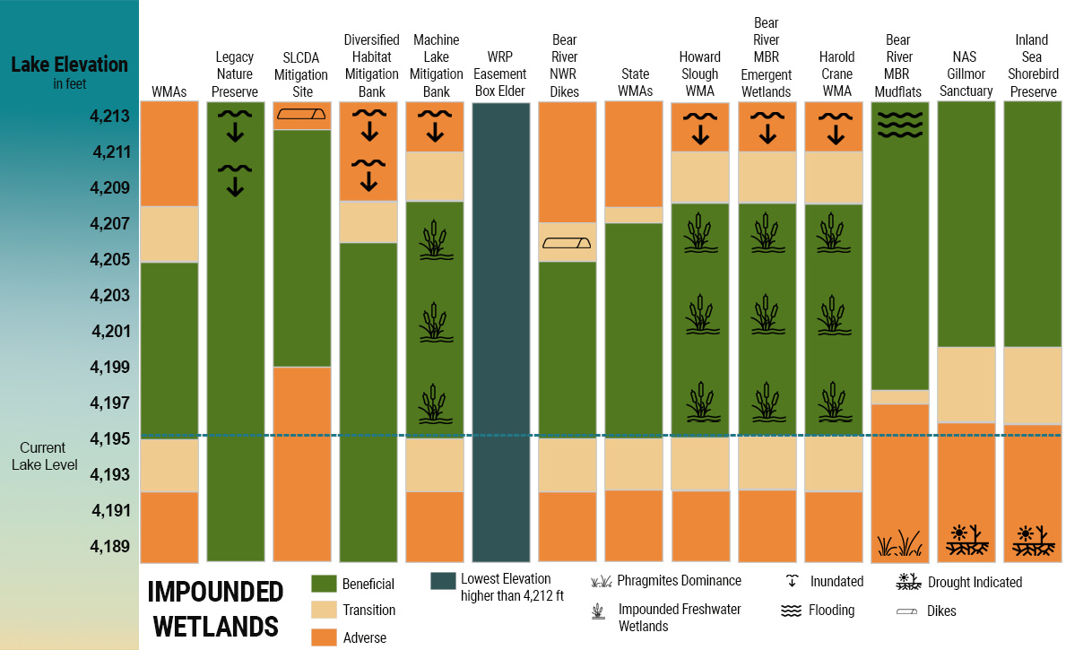
Impounded wetlands form where dikes, berms, ditches, and culverts have been constructed to control or constrict the inflow into or outflow of water from the wetlands.
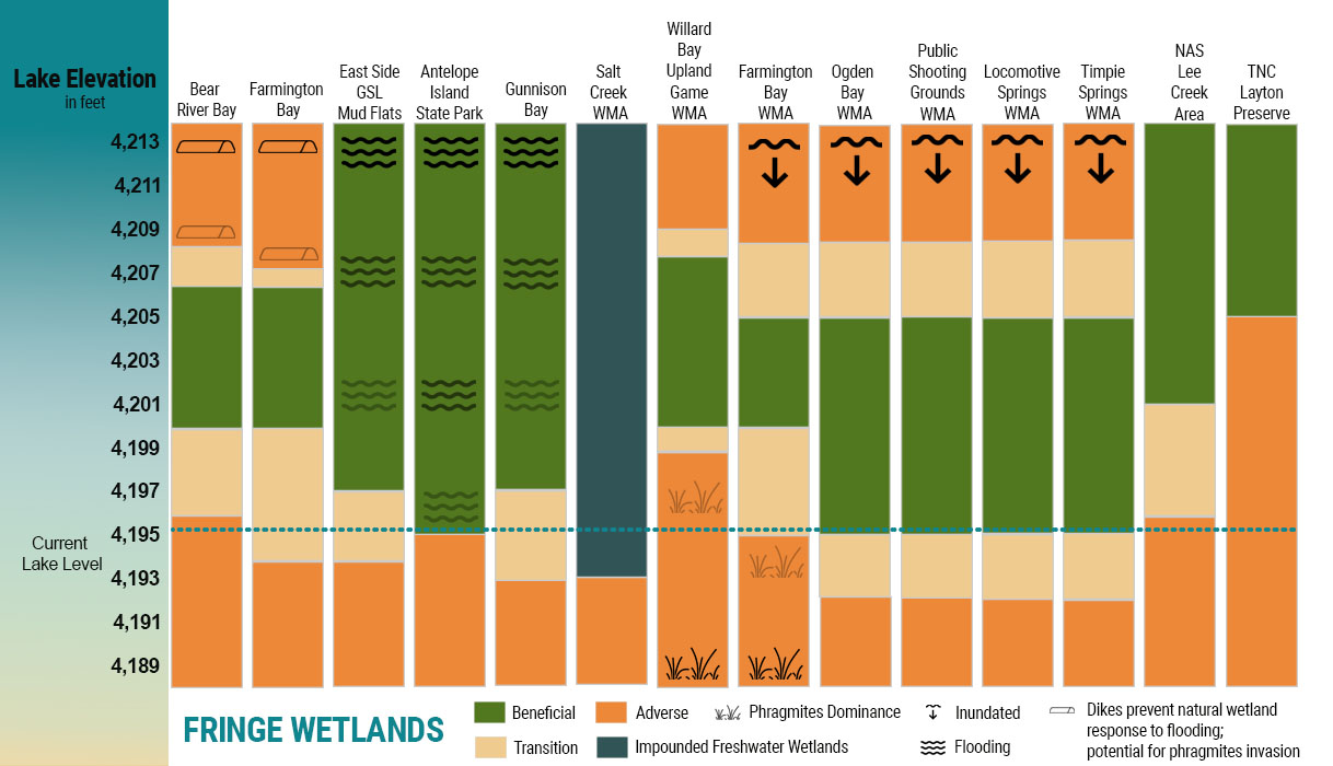
As illustrated in the Lake Level Matrix, fringe (unimpounded) wetlands and impounded wetlands are affected by changes in lake level. Most are subject to inundation at high lake levels, the amount of which varies with base elevation. Similarly, most are subject to desiccation at low lake levels and the potential encroachment of invasive species. The magnitude of these effects is dependent on the specific management goals and infrastructure of each wetland area. For example, high lake levels can cause erosion of dikes, which is integral to waterfowl management (as seen during the floods in the 1980s). Conversely, high salinity in a management area can eradicate Phragmites. Low lake levels and drought conditions require that water is actively moved through wetland management areas. In some years, the USFWS must prioritize those units that receive water on the Bear River Migratory Bird Refuge. This management decision is based on factors such as the capacity to support waterfowl and the capacity to control avian botulism.
Information on this page is from the Final Great Salt Lake Comprehensive Management Plan and Record of Decision.