The Watershed Hydrology Assessment Viewer (WHAV) summarizes new analyses that estimate the 1-percent annual exceedance probability (AEP), which is also referred to as the 100-year return period, and other frequency flows for stream reaches within the highlighted basins shown in the map below.
These analyses are based on a series of studies conducted by the Interagency Flood Risk Management (InFRM) team as an authoritative source of hydrology. The InFRM team used a range of hydrologic methods, including statistical hydrology, rainfall-runoff modeling, and reservoir analyses, to calculate the 1-percent AEP flow and then compared those results to one another.
The goal of the Watershed Hydrology Assessments (WHAs) is to produce consistent 1-percent AEP and other frequency flows across the large, complex river basins, based on all available hydrologic information. The final recommendations of the WHAs are formulated through a rigorous review process which includes technical investigations, external peer reviews, partner input, and collaboration between all InFRM team members.
For more information on the WHA methodology, please download a basin assessment report below.
River basins within the 5 state region shown to the right are prioritized for WHAs based on watersheds where U.S. Army Corps of Engineers (USACE) has sufficiently detailed modeling products available as a starting point and where the Federal Emergency Management Agency (FEMA) has future floodplain mapping activities planned.
As a result of the level of investment, analyses, and collaboration that go into the WHAs, their results are recommended as the best available estimate of flood risk for the studied streams in the river basin, and they provide suggestions for areas where the current flood hazard information may need to be updated. The results from the WHAs can also be used to plan new infrastructure and safely locate new neighborhoods and other urban development. Furthermore, the models and data used to produce these flood risk estimates are available from USACE upon request at no charge.
WHAs that have been completed and WHAs that are underway are listed below.
Click on a completed basin on the map to see detailed assessment report results.
Basin information and hydrologic assessment reports for completed studies are available by basin below.
For more detailed information about the basin studies and how they support the Interagency Flood Risk Management work, please visit the About page. For more information about the Interagency Flood Risk Management program and related resources, please visit the InFRM homepage.
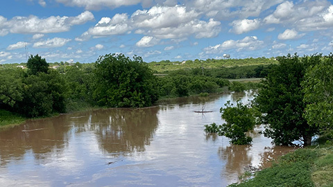
The Colorado River originates on the High Plains near Lamesa, TX and flows southeast for over 860 miles before emptying into Matagorda Bay on the Gulf of Mexico.
Major Tributaries: Concho River, Pecan Bayou, San Saba River, Llano River, Sandy Creek, Pedernales River, and Onion Creek
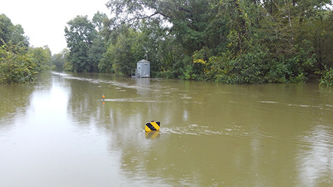
The Neches River begins in Van Zandt County approximately 60 miles southeast of Dallas, Texas. It flows in a southeasterly direction for approximately 416 miles to empty into Sabine Lake, 20 miles southeast of Beaumont, Texas.
Major Tributary: Angelina River

The Trinity River watershed is located in north central Texas and flows southeast to the Gulf of Mexico. The Trinity River Basin drains all or part of 37 counties which includes the Dallas/Fort Worth Metropolitan area that is comprised of 7.5 million people.
Major Tributaries: Mountain, Denton, Cedar, Chambers, and Richland Creeks
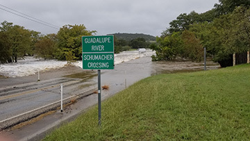
The Guadalupe River Basin begins in the Texas Hill country before crossing the Balcones Escarpment on its way to the Texas Coastal Plains and the Gulf of Mexico. The basin intersects significant portions of Kerr, Kendall, Blanco, Hays, Comal, Travis, Caldwell, Guadalupe, Gonzales, DeWitt, and Victoria counties.
Major Tributaries: San Marcos and Comal Rivers
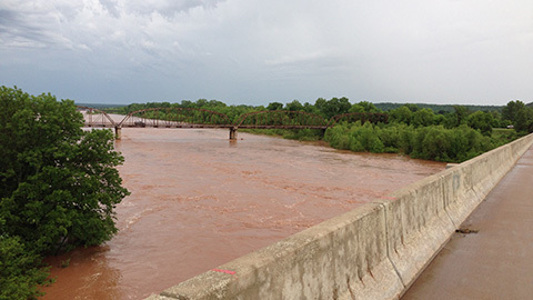
The Little River watershed spans southeastern Oklahoma and southwestern Arkansas and is a tributary of the Red River. The Little River watershed encompasses Le Flore, Pushmataha, Choctaw and McCurtain counties in Oklahoma and Sevier and Polk County in Arkansas where it joins the Red River near Fulton, Arkansas.
Major Tributaries: Glover Creek, Mountain Fork and Rolling Fork

Scheduled completion - Mar 2024
Scheduled completion - Oct 2024
Scheduled completion - Dec 2025