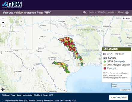
The Colorado River originates on the High Plains near Lamesa, TX and flows southeast for over 860 miles before emptying into Matagorda Bay on the Gulf of Mexico. The Colorado River has seven significant tributaries: the Concho River, Pecan Bayou, the San Saba River, the Llano River, Sandy Creek, Pedernales River, and Onion Creek. Other than Pecan Bayou, all of other major tributaries are spring-fed streams. These streams originate in the Edwards Plateau region.
Three distinct topographic zones exist within the Colorado River. The upper portion of the basin lies in the Great Plains region of New Mexico and Texas. This area is a gently undulating plain with a regional slope to the southeast. The middle basin is represented by the North Central Plains region. Within this zone, the basin is characterized by gently sloped to steep rolling hills and eroded areas. The Edwards Plateau lies within this zone. The last topographic zone is known as the Gulf Coastal Plains. This area is represented by rolling hills at the northwestern boundary to flat relief near the coast. This watershed assessment focuses on all portions of the Colorado River basin from E.V. Spence Reservoir near Robert Lee, Texas to the gulf, and that study area will be referred to as the Lower Colorado River basin.
The unique shape and variable topography of the Colorado River basin drive a highly variable experience of flood risk throughout the basin. Peak flood flows on the Colorado River mainstem tend to be driven by its major tributaries. The steep hill country tributaries in the middle portion of the basin in particular (San Saba, Llano, Pedernales, etc.) have generated some of the highest observed peak stream flows observed within the Colorado basin. Downstream of Austin, the narrowing shape of the Colorado watershed and the widening floodplains of the coastal plains tend to reduce peak flows of the floods as they travel downstream.
For more information, refer to the Lower Colorado River Basin Assessment Report
Interactive Basin Map

Select the name to open detail pages for each location. For USGS streamgage locations, select the USGS streamgage number to open the real-time data page for that streamgage.
| Name | Site type | Streamgage | Drainage Area (mi2) | Recommended Method (Method Descriptions) |
|---|
Based on data published in the Watershed Hydrology Assessment for the Lower Colorado River Basin report.
Site names and drainage areas displayed on the website are based on the Watershed Hydrology Assessment for the Lower Colorado River Basin. For USGS streamgages, these may not exactly match the official USGS names or drainage areas for a given location. In addition, the drainage areas shown in this application are rounded to the nearest whole number.