Summary of findings from Opsahl and others, 2020
Continuous monitoring of surface water, groundwater, and springs in the San Antonio segment of the Edwards aquifer is a central component of the USGS Urban Hydrology Network in San Antonio. This next generation of hydrologic monitoring technology serves a variety of information needs specific to local communities, including real-time information about water quality and hydrologic conditions for the karstic Edwards aquifer, which is the primary water supply for the city of San Antonio.
USGS "super sites" examine the dynamic connection between urban stormwater runoff and recharge to shallow groundwater of the Edwards aquifer. These sites monitor both streamflow and groundwater levels and are sites of water-quality sample collection during periods of groundwater recharge.

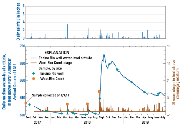
Rainfall at the San Antonio International Airport and continuous water-level altitude, stage data, and sampling dates for the West Elm Creek and Encino Rio well site pair.

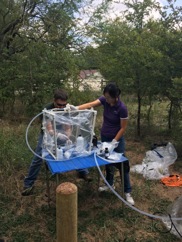
U.S. Geological Survey hydrographers processing a groundwater sample for pesticide analysis at the Encino Rio site.

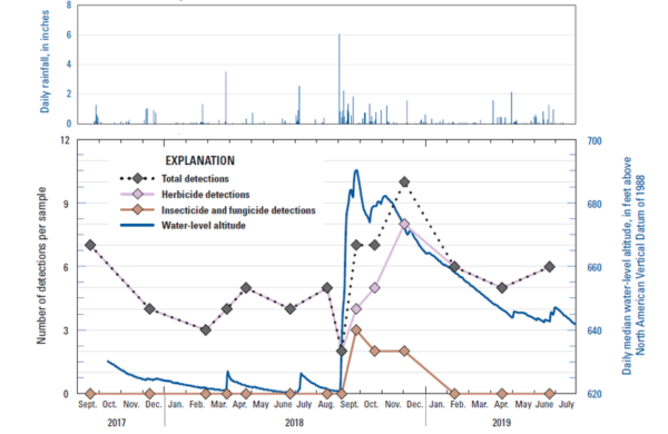
Water-level altitude and the number of detections of herbicides, insecticides plus fungicides, and the total number of detections in samples collected from the Encino Rio well.