

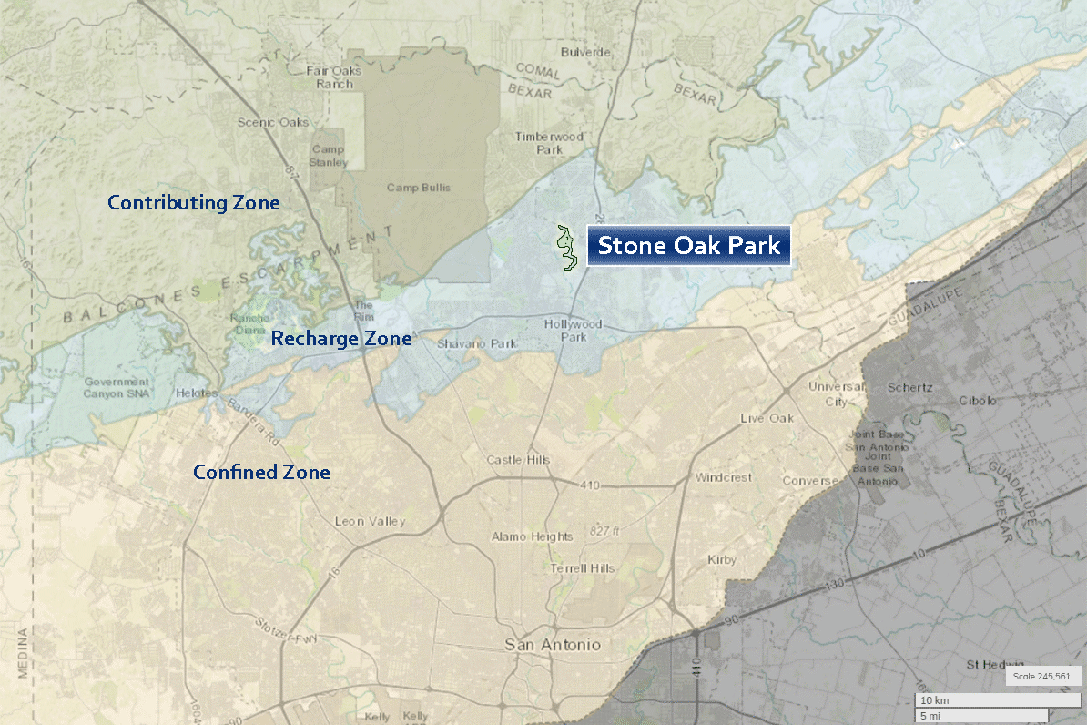
Bear Cave and Cub Cave are karst caves within the Edwards aquifer recharge zone and are located in an urban area of northern San Antonio. Public access to the caves is prohibited. These virtual cave tours were developed to provide the general public with an opportunity to visualize the geology, biology, and physical setting of the caves, and to describe the unique role that this cave system plays in the hydrology of the greater San Antonio area.
Bear Cave and Cub Cave Tours
Northern San Antonio, Texas
Bear Cave and Cub Cave are located in Stone Oak Park in northern San Antonio, within the recharge zone of the Edwards aquifer.
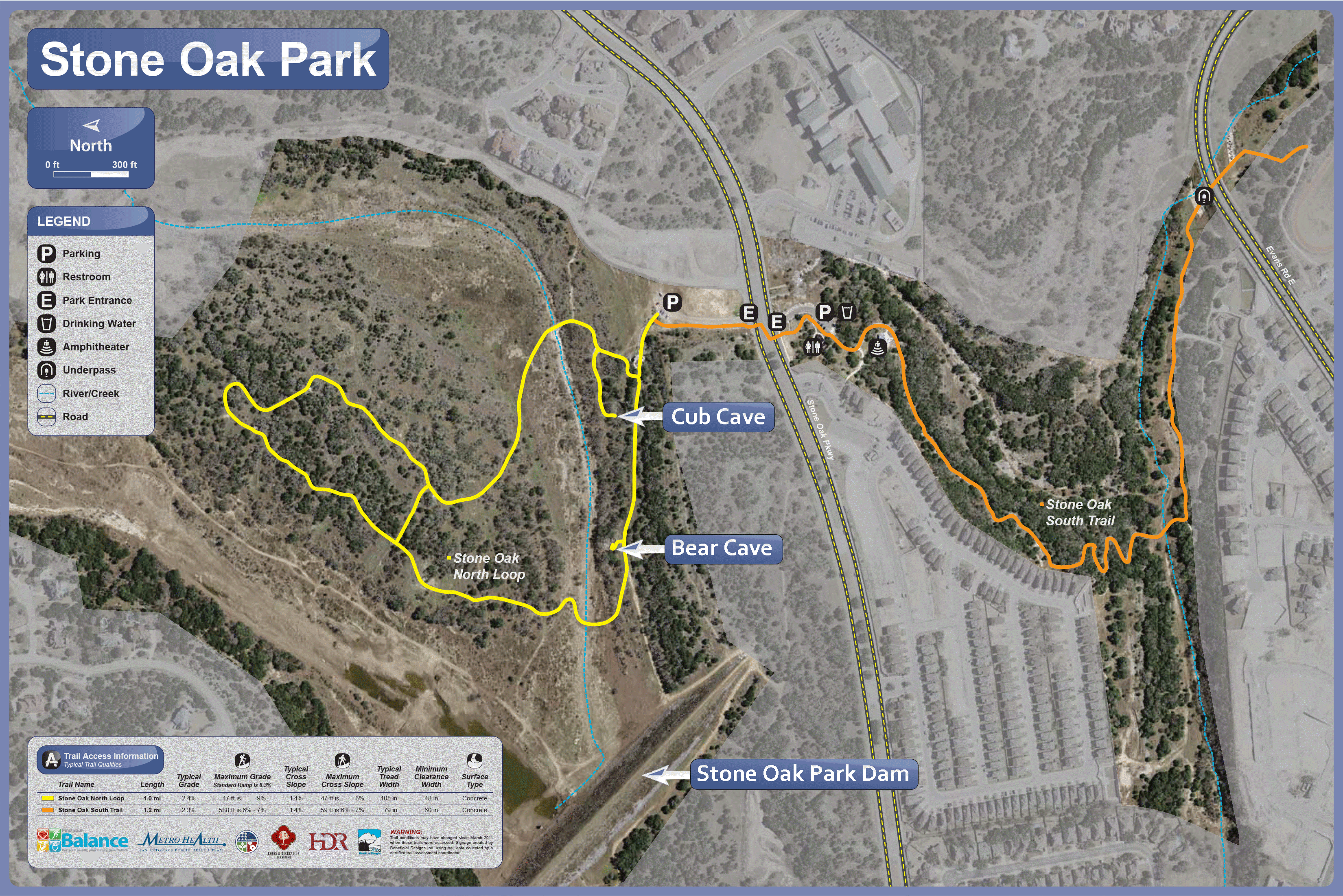
Stone Oak Park
Stone Oak Park is maintained by the City of San Antonio. In addition to protecting recharge features and providing a flood buffer, Stone Oak Park also contains 2.7 miles of walking trails.
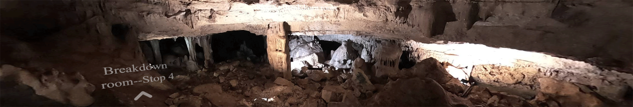
Bear Cave
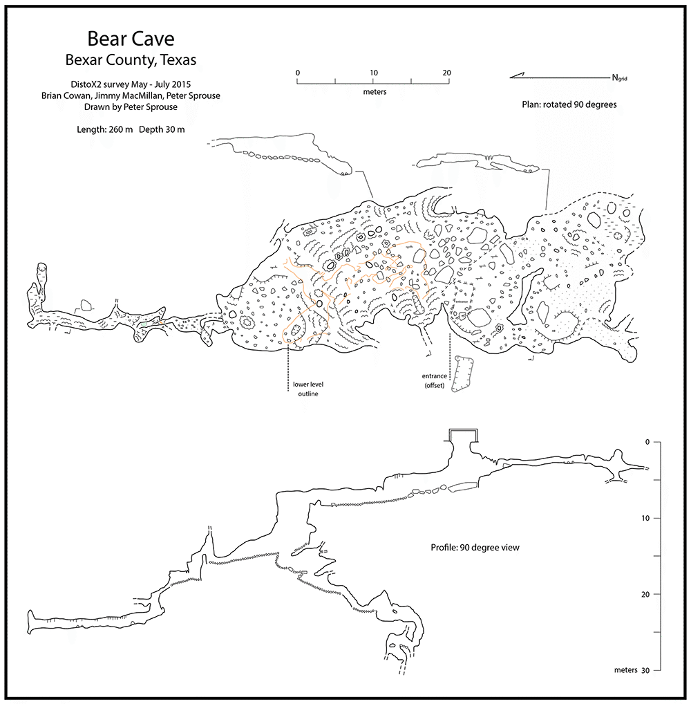
Bear Cave developed as a phreatic chamber which became a site of substantial point recharge to the Edwards aquifer. In the spring of 1973, the San Antonio River Authority completed construction of the Stone Oak Park dam 60 meters downstream from the cave, capitalizing on the recharge potential for the Edwards aquifer.
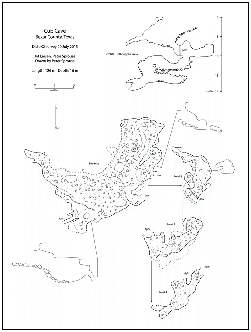
Cub Cave
The first documentation of the cave is on a 1964 location map of Bear Cave. The overhanging entrance has occasionally been used for vertical and rescue training. The cave developed as a phreatic chamber in the recharge zone of the Edwards aquifer.
Credits
Bear and Cub Caves were explored with permission and assistance from the City of San Antonio Parks and Recreation. Cave imagery was collected on June 1 and 15, 2023. Spelunkers were Allan Clark and Stephen Opsahl (USGS), George Veni (George Veni and Associates), Alicia Luna, Wendy Leonard, Kelsey Scherschel, and Casey Cowan (City of San Antonio), and Robert Morris (USGS volunteer).
For more information on the caves, please see The Caves of Bexar County (1988), which includes photos and much more detailed description of the hisory, biology, and geology of these and other caves within Bexar County.
Cave maps provided by Peter Sprouse and used with permission from the Texas Department of Transportation.
Stone Oak Park trail map slightly modified from the original Stone Oak Park trail map and used with permission from the City of San Antonio Parks and Recreation.
Any use of trade, firm, or product names is for descriptive purposes only and does not imply endorsement by the U.S. Government.