Transboundary Aquifer Assessment Program (TAAP)
Binational Publications
Binational Study of the Transboundary San Pedro Aquifer (in English and Spanish)
This study uses new and existing research to define the general framework of the Binational San Pedro Aquifer to understand the current state of knowledge with respect to climate, geology, soils, land cover, land use, and hydrology of the aquifer in its binational context.
Published: 2016
By the International Boundary and Water Commission
Crossing Borders for a Secure Water Future: US-Mexico San Pedro River Aquifer Report
San Pedro River Aquifer Data Release - Transboundary Aquifer Assessment Program (TAAP)
TAAP - Binational Study of the Transboundary San Pedro Aquifer
View Publication (PDF, English) View Publication (PDF, Spanish)
Hydrogeological Activities in the Conejos-Medanos/Mesilla Basin Aquifer, Chihuahua, Phase I
This report's general objective is to update knowledge of the Conejos-Medanos's hydrogeological conditions, and to have necessary hydrogeologic data to determine average annual groundwater recharge, impact of intensive pumping, and variation in natural water quality.
Published: 2011
By the International Boundary and Water Commission, Environmental Reports
View Publication (PDF, English) AppendicesU.S. Federal Publications
Findings and lessons learned from the assessment of the Mexico-United States transboundary San Pedro and Santa Cruz aquifers: The utility of social science in applied hydrologic research
Findings and lessons learned from the integration of social-science perspectives into a largely physical-science based program.
Published: 2018
By J.B. Callegary (USGS), S.B. Megdal (University of Arizona), E.M. Tapia Villaseñor (University of Arizona), J.D. Petersen-Perlman (University of Arizona), I. Minjárez Sosa (Universidad de Sonora), R. Monreal (Universidad de Sonora), F. Gray (USGS), F. Grijalva Noriega (Universidad de Sonora)
View Publication
Three-dimensional Hydrogeologic Framework Model of the Rio Grande Transboundary Region of New Mexico and Texas, USA, and Northern Chihuahua, Mexico
As part of a U.S. Geological Survey study in cooperation with the Bureau of Reclamation, a digital three-dimensional hydrogeologic framework model was constructed for the Rio Grande transboundary region of New Mexico and Texas, USA, and northern Chihuahua, Mexico.
Published: 2017
By Donald S. Sweetkind, USGS
U.S. Geological Survey data release - Transboundary Aquifer Assessment Program (TAAP)
View Publication
Geophysics- and Geochemistry-based Assessment of the Geochemical Characteristics and Groundwater-flow System of the U.S. part of the Mesilla Basin/Conejos-Médanos Aquifer System in Doña Ana County, New Mexico, and El Paso County, Texas, 2010–12
The U.S. Geological Survey in cooperation with the Bureau of Reclamation assessed the groundwater resources in the Mesilla Basin and surrounding areas in Doña Ana County, N. Mex., and El Paso County, Tex.
Published: 2017
By Andrew P. Teeple, USGS
U.S. Geological Survey data release - Transboundary Aquifer Assessment Program (TAAP)
View PublicationRio Grande Transboundary Integrated Hydrologic Model and Water-Availability Analysis, New Mexico and Texas, United States, and Northern Chihuahua, Mexico
This report describes model construction and applications by the U.S. Geological Survey, working in cooperation and collaboration with the Bureau of Reclamation. The goal of this study was to produce an integrated hydrological simulation model to help evaluate water-management strategies, including conjunctive use of surface water and groundwater for historical conditions, and to support long-term planning for the Rio Grande Project.
Published: 2020
By Hanson, R.T., Ritchie, A.B., Boyce, S.E., Galanter, A.E., Ferguson, I.A., Flint, L.E., Flint, A., and Henson, W.R.
U.S. Geological Survey data release - Transboundary Aquifer Assessment Program (TAAP)
View Publication
Geochemical Assessment of the Hueco Bolson, New Mexico and Texas, 2016–17
To better understand water-quality conditions in the Mexico–New Mexico–Texas transboundary area, 23 water-supply wells were sampled in the Hueco Bolson within the United States near El Paso, Tex., during August–September 2016 and May–June 2017. Groundwater samples were analyzed for physical properties, major ions, dissolved solids, nutrients, trace elements, organic compounds, and selected isotopes such as strontium, hydrogen, oxygen, tritium, and carbon-14.
Published: 2020
By Ging, P.B., Humberson, D.G., and Ikard, S.J.
U.S. Geological Survey data release - Transboundary Aquifer Assessment Program (TAAP)
View PublicationState Water Resource Research Institute Publications
Transboundary aquifers between Chihuahua, Coahuila, Nuevo Leon and Tamaulipas, Mexico, and Texas, USA: Identification and categorization
The objective of this study is to identify and classify the transboundary hydrogeological units shared between Chihuahua, Coahuila, Nuevo Leon and Tamaulipas, Mexico, and Texas, and assess their potential transboundary linkages.
Published: 2018
By Rosario Sanchez (TAMU), Laura Rodriguez, Cecilia Tortajada
View Publication (PDF)
The Transboundariness Approach and Prioritization of Transboundary Aquifers between Mexico and Texas
“Transboundariness” refers to a new approach that identifies and prioritizes transboundary aquifers using socio-economic and political criteria, improving their characterization by using other variables in addition to their mere physical boundaries. This approach is applied to the hydrogeological units/aquifers shared by Mexico and Texas.
Published: 2018
By Rosario Sanchez (TAMU), Laura Rodriguez, Cecilia Tortajada
View Publication (PDF)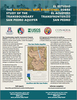
TAAP-A/S Bulletin on the Binational Study of the Transboundary San Pedro Aquifer (in English and Spanish)
This is a summary brochure of the Binational Study of the Transboundary San Pedro Aquifer. The Transboundary Aquifer Assessment Program (TAAP) is a joint effort between Mexico and the United States to evaluate shared aquifers. The Binational Study of the Transboundary San Pedro Aquifer is a milestone output of this joint effort.
Published: 2017
By the University of Arizona Water Resources Research Center
View Publication (PDF)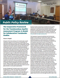
The Cooperative Framework for the Transboundary Aquifer Assessment Program: A Model for Collaborative Transborder Studies
The successful ongoing collaboration confirms the value of the time spent at the front-end to develop the Cooperative Framework. The team was able to persevere despite uncertain and very limited funding and the challenges of working in different languages and across an international border.
Published: 2017
By Sharon Megdal, University of Arizona Water Resources Research Center
View Publication (PDF) View Publication (PDF, Spanish)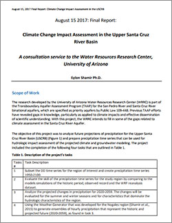
Climate Change Impact Assessment in the Upper Santa Cruz River Basin
Future projections of Upper Santa Cruz River Basin precipitation were analyzed to prepare time series data for use in a hydrologic impact assessment.
Published: 2017
By Eylon Shamir, University of Arizona Water Resources Research Center
View Publication (PDF)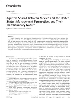
Aquifers Shared Between Mexico and the United States: Management Perspectives and Their Transboundary Nature
Management mechanisms, structures, and institutional prioritization related to transboundary aquifers shared between Mexico and the United States were identified.
Published: 2017
By Rosario Sanchez and Gabriel Eckstein
View Publication
The Importance of Institutional Asymmetries to the Development of Binational Aquifer Assessment Programs: The Arizona-Sonora Experience
This paper examines current binational efforts to develop the scientific information to support water management decision making along the United States-Mexico border. The particular focus is on transboundary aquifers along the border shared by the states of Arizona in the United States and Sonora in Mexico.
Published: 2011
By Sharon Megdal and Christoper Scott
View Publication
An Integrated Geochemical Approach for Defining Sources of Groundwater Salinity in the Southern Rio Grande Valley of the Mesilla Basin, New Mexico and West Texas, USA
A significantly elevated groundwater salinity zone was identified in the southern part of the Mesilla Valley. This investigation characterized the occurrence, spatial extent, and source of the plume of elevated groundwater salinity using a wide range of geochemical and geophysical data and methods.
Published: 2021
By Kubicki, C., Carroll, K.C., Witcher, J.C., and Robertson, A.
View PublicationRelated Research
Identifying and Characterizing Transboundary Aquifers Along the Mexico–U.S. Border: An Initial Assessment
There is a conceptual and institutional void regarding transboundary groundwater resources between Mexico and the United Statess. The purpose of this paper is to bridge this void and characterize transboundary aquifers on the Mexico–U.S. border.
Published: 2016
By Rosario Sanchez, Victoria Lopez, and Gabriel Eckstein
View PublicationU.S. Federal Data Releases
Borehole temperature profiles measured in the Mesilla Basin, New Mexico during the period 1972 through 2018
Compilation (index and individual .txt data files) of 379 borehole temperature profiles collected during the period 1972 through 2018 for the Mesilla Basin, New Mexico.
Published: 2016
By Rosario Sanchez, Victoria Lopez, and Gabriel Eckstein
View PublicationTime-Domain Electromagnetic Data Used in the Assessment of the Freshwater/Saline-Water Transition Zone within the Hueco Bolson, Fort Bliss Area, El Paso, Texas 2017-2019
To help delineate the freshwater and saline groundwater transition zone, 20 time-domain electromagnetic soundings were collected to provide resistivity structure data in the area. This dataset consists of all collected raw data as well as processed results for each sounding.
Published: 2020
By Payne, J.D., Teeple, A.P, and Ikard, S.J.
View PublicationGroundwater withdrawals from the Hueco Bolson, Mesilla Basin, and the Rio Grande alluvium in El Paso and Hudspeth Counties, Texas, 1980-2018
This data release contains compiled groundwater withdrawal data from 1980 to 2018 for the Hueco Bolson, Mesilla Basin, and the Rio Grande alluvium in El Paso and Hudspeth Counties, Texas.
Published: 2020
By Houston, N.A., and Pasley, N.K
View PublicationAdditional compiled publications and data relating to surface water and groundwater resources between Mexico and the United States can be found within the Transboundary Water Portal.


