
The Trinity River watershed is located in north central Texas and flows southeast to the Gulf of Mexico. The Trinity River watershed has a drainage area of 17,969 square miles. There are also approximately 2,000 miles of major tributaries that drain into the Trinity River. The Trinity River has four upstream branches, the West Fork, the Clear Fork, the Elm Fork, and the East Fork. The Trinity River main stem starts at the confluence of the Elm Fork and West Fork in Dallas, Texas. Major tributaries to the Trinity River include Mountain Creek, Denton Creek, Cedar Creek, Chambers Creek, and Richland Creek.
The Trinity Basin includes eight USACE reservoirs. Benbrook Lake, Joe Pool Lake, Grapevine Lake, Ray Roberts Lake, Lewisville Lake, and Lavon Lake are located in or near the Dallas/Fort Worth metropolitan area. Navarro Mills Lake and Bardwell Lake are in the lower portion of the Trinity River watershed.
The precipitation varies between the upper (northwest) to lower (southeast) extents of the basin. The upper extent receives an annual average 35-40 inches of precipitation; the average annual precipitation in the lower extent exceeds 50 inches. The basin, particularly in the southeast, can experience extremely intense precipitation events capable of producing staggering rainfall totals. These systems range from intense thunderstorms to hurricanes.
The Trinity River basin has a history of flooding that spans back to 1908 and 1922, when major flood stages were recorded at Dallas and Fort Worth Texas. Streamflow records show that major floods have been experienced over nearly all areas of the Trinity River Basin. In the last 30 years, there have been major floods in the Trinity River basin in 1990, 1991, and 2015.
Interactive Basin Map
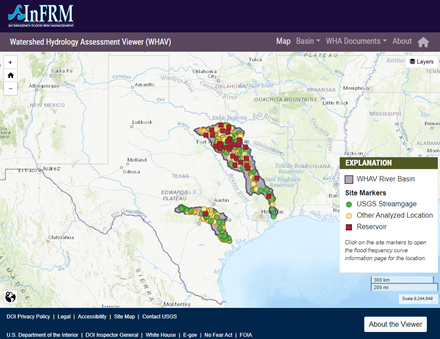
Select the name to open detail pages for each location. For USGS streamgage locations, select the USGS streamgage number to open the real-time data page for that streamgage.
| Name | Site type | USGS Site ID | Drainage Area (mi2) | Recommended Method (Method Descriptions) |
|---|
Based on data published in the Watershed Hydrology Assessment for the Trinity River Basin report.
Site names and drainage areas displayed on the website are based on the Watershed Hydrology Assessment for the Trinity River Basin. For USGS streamgages, these may not exactly match the official USGS names or drainage areas for a given location. In addition, the drainage areas shown in this application are rounded to the nearest whole number.