
Additional Data
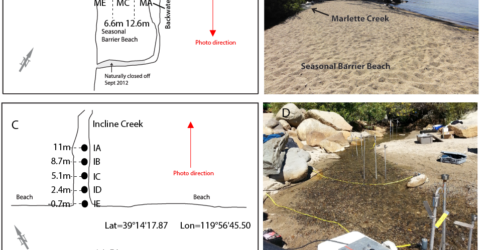
Water Quality and sediment temperature
Water-quality and sediment-temperature data were collected to estimate nitrogen and phosphorus nutrient loads from Incline and Marlette Creeks to Lake Tahoe. Data were evaluated to better understand biogeochemical processes within the stream-lake interface.
Date Collected: September 2013
Data Collected: Sediment and water temperature, dissolved nitrate plus nitrite, dissolved, ammonium, total Kjeldahl nitrogen, soluble orthophosphate, dissolved phosphorus, total phosphorus, and dissolved organic carbon.
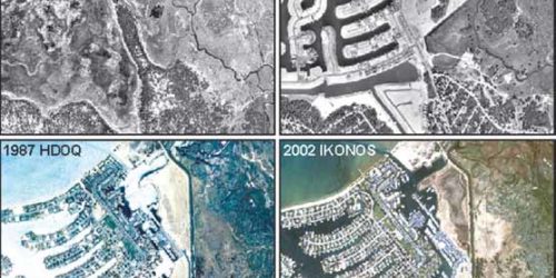
Historical Orthoimagery
USGS Western Geographic Science Center developed a series of historical digital orthoimagery (HDO) datasets photogrammically from aerial photography with varying scales, camera characteristics, image quality, and capture dates.
Data Available:
- 1940 - southern Lake Tahoe Basin,
- 1969 - entire Lake Tahoe Basin, and
- 1987 - southern Lake Tahoe Basin.
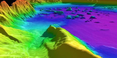
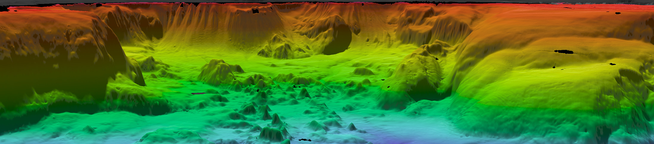
Bathymetry
USGS Pacific Coastal and Marine Science Center, in cooperation with the University of New Brunswick, Canada Ocean Mapping Group, conducted a bathymetric survey to study the morphology and material of the lake floor.
Date Collected: August 1998
Data Available: Bathymetric (depth information) and backscatter (the strength of sound energy that bounces back).
Digital Data From Lake Tahoe Data Clearinghouse
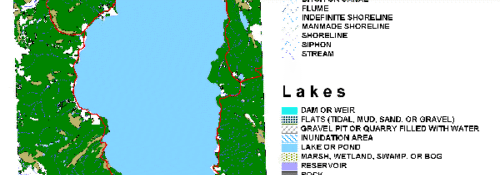
Digital Line Graph (DLG)
DLGs are a digital vector representation of cartographic information derived from USGS maps and related sources.
Created From: 18 7.5-minute quadrangles that cover the Lake Tahoe Basin.
Created Using: UTM NAD27 zone 10 projection in compressed Shapefile format.
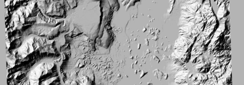
Digital Elevation Model (DEM)
Created From: 18 7.5-minute quadrangles of 10-m DEMs and data collected on a 1988 bathymetric survey of the lake.
Created Using: UTM NAD27 zone 10 projection.
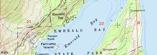
Digital Orthophoto Quadrangle (DOQ)
A standard DOQ covers a quarter section of a 7.5-minute quadrangle.
File Sizes: 1-m resolution quarter section is about 50 megabytes (MB) and complete DOQ is about 3 gigabytes (GB).
Created From: Multiresolution seamless image database (MrSID) compression and a .sid file format.
Created Using: UTM NAD83 zone 10 projection.
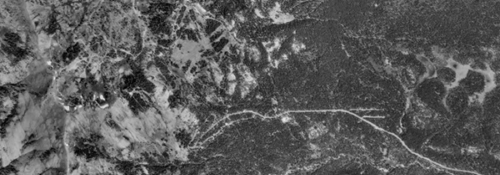
Digital Raster Graphic (DRG)
DRGs are lower resolution and have a smaller file size than DOQs; the Lake Tahoe Basin mosaic is about 81 MB in size.
Created From: Eighteen USGS 7.5-minute topographic maps mosaicked using MrSID compression and a .sid file format.
Created Using: UTM NAD27 zone 10 projection.