Data Collection
Streamflow permanence data are generally sparse. Data collection on surface flow conditions is typically focused on larger streams and rivers that are perennial and not subject to stream drying. Where streamflow permanence datasets exist, they tend to be siloed in different agencies and groups and not readily available for broader use and application. The FLOwPER mobile application is a standardized way to collect information on surface flow presence and absence to be stored in the publicly-accessible FLOwPER database. Streamflow permanence predictions for streams in the Pacific Northwest from the PROSPER model can be viewed in StreamStats through the Exploration Tools.
FLOwPER
FLOwPER is a field-survey tool that focuses on the rapid collection of streamflow permanence observations across large spatial and temporal scales and functions across a wide range of mobile devices to facilitate crowdsourcing data from different organizations for storage in a central database.
The FLOwPER survey:
- Identifies surface flow conditions at a point location on the landscape. Locations can include stream channels, wetlands, or any other feature of interest.
- Is a standardized method to collect information on surface flow presence and absence for storage in a publicly-accessible database.

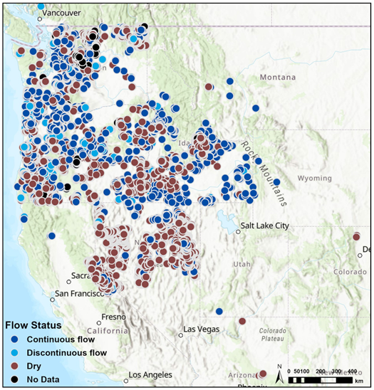
FLOwPER database obervations by year, 2019-24
The FLOwPER mobile data collection effort has nearly 28,000 flow permanence observations from 2019-24. These data are periodically reviewed and published as ScienceBase data releases so they are available to anyone who may wish to use them.
FLOwPER DatabaseGet Involved
- Find out more information
- Get access to the FLOwPER AGOL group by emailing us at [email protected]
- Help collect data by emailing us at [email protected]
- Select observation locations using the FLOwPER prioritization map
FLOwPER Prioritization Map
The FLOwPER Prioritization Map is designed to help users identify observation locations (stream reaches) for data collection that will best inform modeled estimates of streamflow permanence. This map does NOT contain information on streamflow permanence. It presents priority locations for FLOwPER data collection using transparency and line width of the flowlines on the map. Thinner, more transparent lines represent stream reaches that can be modeled with relative confidence; these are lower priority reaches for FLOwPER data collection. Wider, more opaque lines represent stream reaches that can be modeled with relatively less confidence; these are higher priority reaches for FLOwPER data collection.