Understanding Springflow
Springflow is the amount of water in a stream that came directly from groundwater, often through springs or seeps. These groundwater sources may be visibly flowing into the stream or they may be less obviously entering from below the water surface.
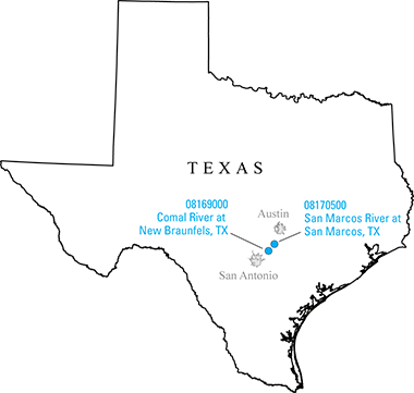
Springflow cannot always be measured directly at Comal or San Marcos springs. Instead, the USGS measures streamflow at two gages located downstream from the spring networks, Comal River at New Braunfels and San Marcos River at San Marcos .
What is the difference between Springflow and Streamflow?
Streamflow at these two locations is made up of springflow (from springs and seeps) and surface-water runoff (from storm events).
- During non-storm periods, all streamflow at these two gages comes from springflow.
- During storm events, the relative contributions of springflow and surface water runoff are estimated by USGS staff.
After the storm events, springflow is recalculated using a computer program following standard springflow separation methods and the previous estimates are updated with the newer values. The computed springflow values are calculated and checked each weekday before being released online.
Why Comal and San Marcos?
The Comal and San Marcos Springs are the largest major springs in the San Antonio segment of the Edwards Aquifer in central Texas, and among the largest springs in the southwestern US. The Comal springs network in New Braunfels includes 9 main springs and hundreds of smaller springs, many located under Landa Lake. Likewise, the San Marcos springs network in San Marcos is made up of hundreds of small springs under Spring Lake.
This spring water provides habitat for endangered and threatened species that are required to be protected, provides water for supply and recreational uses, and provides fresh water that flows to the Guadalupe River and to the Gulf of Mexico. Water resource managers must know the amount of springflow to make daily decisions to balance the many water needs, particularly during periods of low flow.
Common Data Questions
or ... Why is springflow the same as streamflow most of the time, but not all of the time?
Streamflow is the combination of surface-water runoff and springflow. Surface-water runoff, as its name suggests, is the overland flow resulting from rainfall that is not absorbed into the ground. Springflow is the groundwater contribution to streamflow, often in the form of springs or seeps.
During dry weather, springflow makes up the majority of the streamflow.
or ... I checked streamflow earlier today and now I see that it has changed. Why is that?
The USGS measures streamflow at gaging stations every 15 minutes, commonly referred to as real-time measurements. The daily average streamflow is the average of the 15-minute streamflow measurements over the course of that day. Springflow is based on the daily average streamflow, not on the 15-minute streamflow data.
or ... I downloaded last month's data, and now I see that the value for some of those past dates has changed. How can that be?
During storm events, the computer program is not able to separate streamflow into surface-water runoff and springflow; hence, the springflow is manually estimated by USGS staff. After the storm event, the computer program is rerun and the estimated values are replaced with the computer calculated values.
Historical values may also change when the USGS performs a series of quality-control checks as part of reviewing the data. For example, routine streamflow measurements are made at the site to ensure the reported values are accurate. The reported values may be updated slightly to match the field measurements more closely.
The reported springflow values undergo multiple quality control checks. As part of those checks, some springflow values may be temporarily removed until all of the QA/QC processes are performed and the data are finalized (e.g., when “shifts” are applied to historical data).
Recent data provided by the USGS – including streamflow and springflow – are considered provisional data and subject to revision. Most data relayed by satellite or other telemetry have received little or no review. Inaccuracies in the data may be present because of instrument malfunctions or physical changes at the measurement site. Subsequent review may result in significant revisions to the data.
Data users are cautioned to consider carefully the provisional nature of the information before using it for decisions that concern personal or public safety or the conduct of business that involves substantial monetary or operational consequences.
Information concerning this springflow separation method or accuracy and appropriate uses of these hydrologic data may be obtained by contacting USGS Oklahoma-Texas Water Science Center.
![]() This webpage was developed in cooperation with the
Edwards Aquifer Authority
This webpage was developed in cooperation with the
Edwards Aquifer Authority
Note: As of 07/11/2025, this webpage is currently under review as it is updated for continued operation.