About the Springs
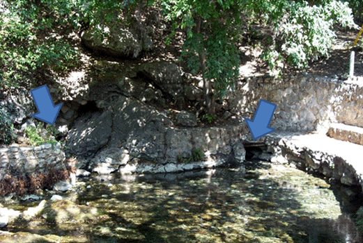
discharge from the Edwards aquifer, including several under Landa Lake.
Comal Springs and Comal River
Comal Springs of Central Texas are the largest springs in the southwestern United States. The artesian springs emerge at the base of an escarpment formed by the Comal Springs fault. The Comal River is approximately 2 miles long and is a tributary of the Guadalupe River.
In addition to being an important economic resource of the region, the springs and associated river system are home to unique aquatic threatened native species, such as:
- Fountain darter (Etheostoma fonticola)
- Comal Springs riffle beetle (Heterelmis comalensis)
- Comal Springs dryopid beetle (Stygoparnus comalensis)
- Peck's cave amphipod (Stygobromus pecki)
Modified from USGS Fact Sheet 099-97, Water Quality Assessment of the Comal Springs Riverine System, New Braunfels, Texas, 1993-94.
Monitoring history
USGS 08169000, Comal River at New Braunfels
- 1882 to Nov. 1927 (discharge measurements only)
- Dec. 1927 to Sept. 1932 (daily mean discharges below base, and stage-discharge relation is not affected by backwater from Guadalupe River)
- Oct. 1932 to current year
USGS 08168710, Comal Springs at New Braunfels
- Dec. 1927 to Sept. 1932 (fragmentary daily springflow discharges)
- Oct. 1932 to current year
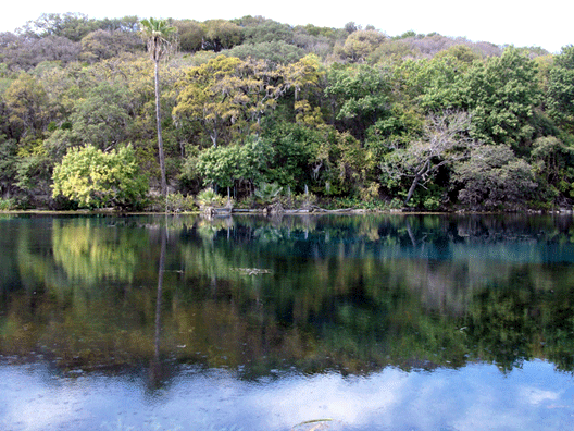
issue from the Edwards aquifer at the bottom of the lake.
San Marcos Springs and San Marcos River
San Marcos Springs is the second largest spring in Texas and is the headwaters for the San Marcos River in San Marcos.Spring Lake was built in 1848 at the site of a marsh formed by the springs to provide hydropower to a mill. The San Marcos River originates from the 15-acre lake and flows approximately 4 river miles (mi) south to its confluence with the Blanco River.
The water from San Marcos Springs is some of the most pristine in Texas. In addition to being a valued economic and recreational resource to the region, San Marcos Springs and the associated riverine system provide habitat to several unique threatened or endangered native species, such as:
- Fountain darter (Etheostoma fonticola)
- San Marcos gambusia (Gambusia georgei)
- Texas blind salamander (Typhlomolge rathbuni)
- Texas wild rice (Zizania texana)
- San Marcos salamander (Eurycea nana)
Modified from USGS Fact Sheet 059-97, Water-Quality Summary of the San Marcos Springs Riverine System, San Marcos, Texas, July-August 1994.
Monitoring history
USGS 08170500, San Marcos River at San Marcos
- July 1915 to Sept. 1921 (daily mean discharges below base discharge)
- May to Sept. 1956
- Oct. 1994 to current year
USGS 08170000, San Marcos Springs at San Marcos
- May 1956 to current year
For more information about streamflow and springflow, please contact the USGS Oklahoma-Texas Water Science Center.