Hink & Ohmart Vegetation
Hink and Ohmart vegetation classifications.
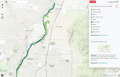
Hink & Ohmart Vegetation 1984
- Classification: HO1984
- File reduced to 2002 extent
- Upstream limit: Santa Ana Pueblo
- Downstream limit: San Acacia Diversion Dam
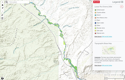
Hink & Ohmart Vegetation 200X
- Classification: HO2002
- Upstream limit: Abiquiu Dam
- Downstream limit: Ohkay Owingeh Pueblo
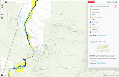
Hink & Ohmart Vegetation 2003
- Classification: HO2002
- Upstream limit: RM 166 – Isleta Pueblo boundary
- Downstream limit: RM 62 – upstream of Elephant Butte Reservoir
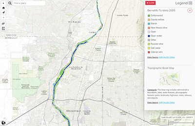
Hink & Ohmart Vegetation 2005
- Classification: HO2002
- Downstream limit: RM 172.5 – I-25 (upstream of Isleta Pueblo boundary)
- Upstream limit: RM 204 – Hwy 550
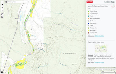
Hink & Ohmart Vegetation 2012
- Classification: HO2002, HO2008, HO2012
- Upstream limit: RM 166 – Isleta Pueblo boundary
- Downstream limit: RM 27 – Elephant Butte Reservoir
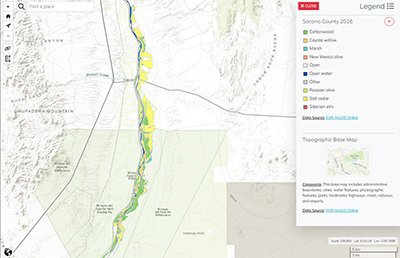
Hink & Ohmart Vegetation 2016
- Classification:
- Upstream limit: RM 140 -- northern border of Socorro County
- Downstream limit: RM 51 -- southern border of Socorro County
Metadata
Metadata is not available.
Data sets presented here are listed with permission from the agency or entity which created the data set. For archived data sets, contact the person listed under "Data Contact".