The Challenge
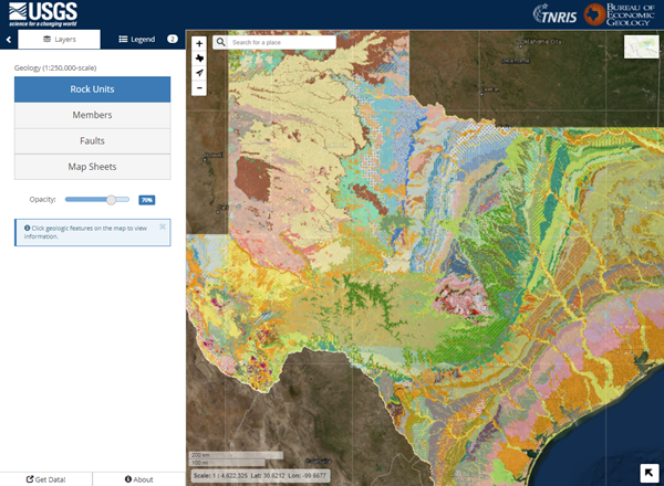
The Geologic Atlas of Texas is a series of 38 hard copy map sheets depicting surface geology for the entire state of Texas. In 2002, USGS partnered with the Texas Natural Resources Information System (TNRIS) to digitize all 38 hardcopy map sheets and compile them into a single, stand-alone Geologic Database of Texas. More than 145,000 geologic features are available in the dataset. An easier solution is needed for people to explore this dataset.
Our Solution
Build a web mapping application for users to explore the geology of Texas that includes
- Pan and Zoom tools
- Location Search tool: search for common geographic place names, latitude/longitude coordinates, and other areas of interest, or
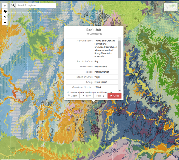
- Identify tool: retrieve detailed information about each geologic formation, such as the feature name, geologic age, feature description, and more
What We Did
Geospatial Analysis
Javascript Development
Visual Design
Web Map Development
Tools We Used
ArcGIS Server
Javascript
Leaflet
SQL Server
HTML/CSS