
Integrated Hydrology + Data Science
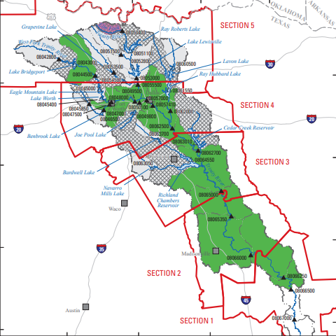
In Texas, surface water in rivers is managed by different river authorities across the State. River authorities and entities along with the U.S. Army Corps of Engineers (USACE) Fort Worth District operate and maintain reservoirs for water conservation, water supply, and recreation. Water management strategies are based, in part, on period-of-record simulations of streamflow and reservoir storage and release. Temporal changes in streamflow from land-use changes, changes in climatic patterns, or other changes, may result in over- or under-estimation of streamflow in simulations, thus providing an inaccurate analysis on which to base water management strategies. Documenting trends in streamflow over time could better inform water managers of the appropriateness of period-of-record streamflow simulations for making water management decisions.
IHDS hydrologists
Data Analysis
Geospatial Analysis
Science Communication
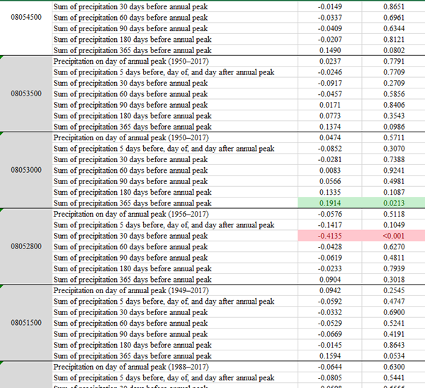
Trend Analysis
ArcGIS Pro
Additional Products
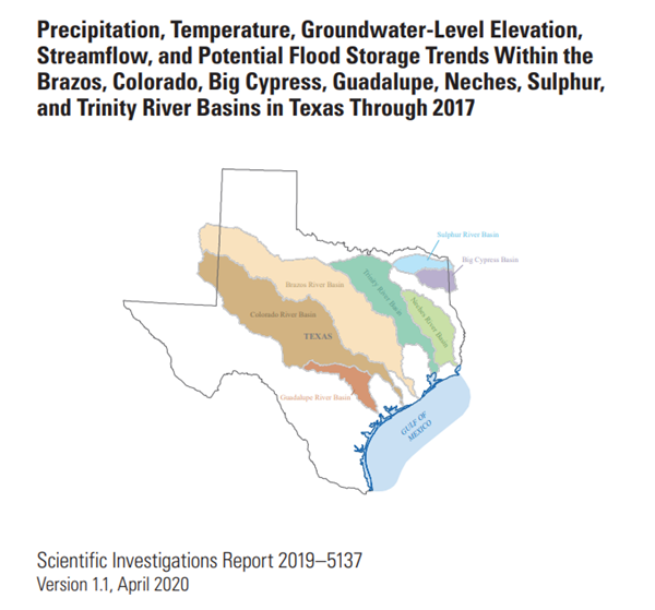
USGS Scientific Investigations Report 2019-5137
Data used to assess precipitation, temperature, groundwater-level elevation, streamflow, and potential flood storage trends within the Brazos, Colorado, Big Cypress, Guadalupe, Neches, Sulphur, and Trinity River Basins in Texas through 2017