The Challenge
USGS has more than 12,000 digital borehole geophysical logs at over 2,500 locations. A wide range of borehole log types are available, including acoustic, caliper, electric, electromagnetic, fluid, lithologic, nuclear, optical, well construction, or a combination or composite of these types. File formats include ASCII, DOC, IMG, LAS, PDF and original. Where possible, geophysical logs are available in Log ASCII Standard (LAS) v2.0, a format developed by the Canadian Well Logging Society. A database and web tool are needed to make these logs available to the public.
Our Solution
Build a database/web tool that allows USGS users to upload, review and approve logs.
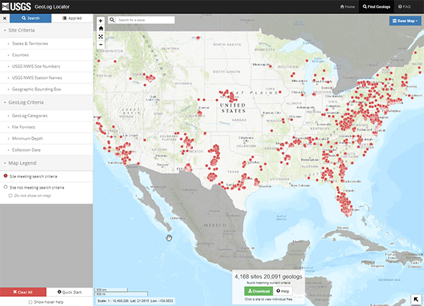
Design a map interface for the public where users can:
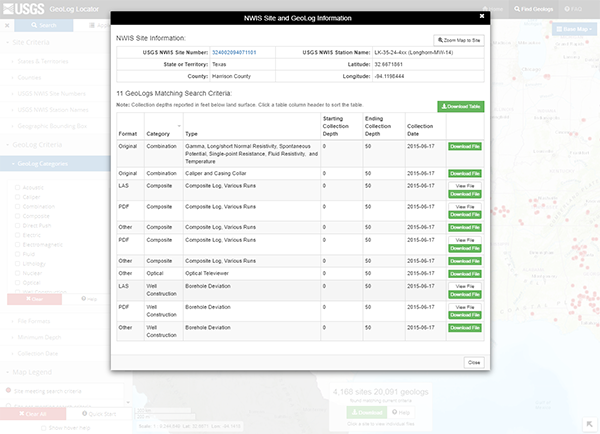
- zoom and click on individual borehole locations to view and download available logs.
- search by state, county, USGS National Water Information System, or NWIS, site number or station name, or by using a geographic bounding area.
- search by log criteria, such as log category (generally logging tool type), file format, minimum logging depth, or log collection date range.
- download logs in batches that result from search criteria or download logs individually.
What We Did
App Development
Digital Architecture
Javascript Development
Web Map Development
Tools We Used
Javascript
Leaflet
SQL Server
Bootstrap