Integrated Hydrology + Data Science
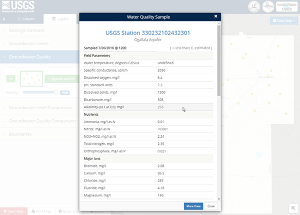
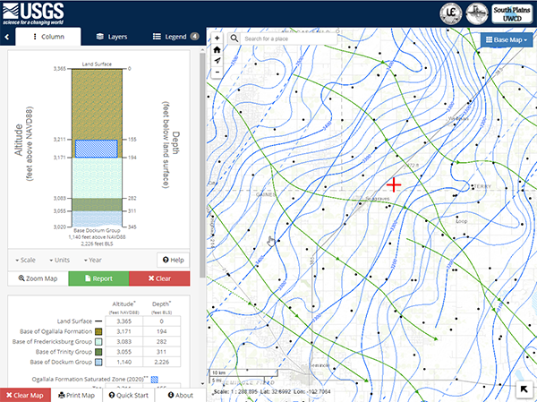
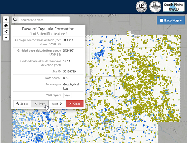
The USGS Oklahoma-Texas Water Science Center (OTWSC) developed a regional conceptual model of the hydrogeologic framework and geochemistry of the Ogallala, Edwards-Trinity, and Dockum aquifers and documented changes between early development (1930-60) and recent (2005-15) groundwater-level altitudes and dissolved-solids and nitrate concentrations in the area. OTWSC needed a way to show model results and the changes within the aquifers.
Build web map services for available data.
Design an interactive web application that allows users to
App Development
Data Visualization
Design Strategy
Javascript Development
Managed Maintenance and Support
Web Map Development
ArcGIS Server
Javascript
Leaflet
ChartJS