USGS Investigators: Marissa Cassell
NPS Investigators: Jonathan Malzone
| 2026 | 2027 |
|---|---|
| $74,878 | $74,944 |
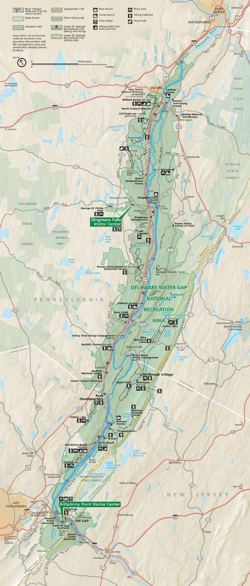
NPS Park: Delaware Water Gap NRA
USGS Center: Pennsylvania Water Science Center
States: PA
The Delaware Water Gap National Recreation Area (DEWA) is the 17th most visited National Park Service unit in the country. Central to the park are its rivers and streams, many classified as “Special Protection Waters”, which provide drinking water, aquatic habitat, and a range of recreational opportunities. However, over the last 30 years, long-term declines in water quality have been observed. Increasing salinity is of particular concern due to increased development and deicing salt application within and surrounding the park. Increasing salinity can negatively impact biota (many falling under Federal and State protection), ecosystems, and the water supply, which can ultimately decrease recreational opportunities at the park.
This project will investigate salinity concentrations throughout the park by collecting two key parameters: specific conductance and chloride concentration data. Specific conductance, which reflects how well water conducts electricity and is closely related to salinity, will be measured at many locations within DEWA using a field instrument to better understand the spatial variability of salinity. The specific conductance data will then be used to inform chloride concentration sampling locations from streams, springs, and wetlands during the winter months of 2026-2027. The latter will provide a direct measure of the salt content in surface waters in the DEWA.
The specific conductance and chloride data, along with legacy data collected within and around the park, will be compiled into a mapper which the park can use to help inform salt application on park-managed roads.