USGS Investigators: Justin Boldt
NPS Investigators: Bobby Carson
| 2017 |
|---|
| $50,000 |
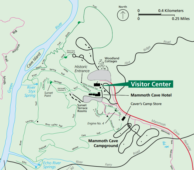
NPS Park: Mammoth Cave NP
USGS Center: Ohio-Kentucky-Indiana Water Science Center
States: KY
The potential for catastrophic environmental and economic impacts from spills and other anthropogenic activities is ever present for our national resources, especially those resources directly related to and/or developed by hydrologic and hydraulic processes such as Mammoth Cave National Park (MACA).
This project will develop better hydrologic analysis and information management tools needed to improve the protection of surface water and groundwater flow systems within Mammoth Cave National Park.
The objectives are to: