California Oil, Gas, and Groundwater Program
Digitization and Mining of Public Oil Well Records
Information on this page from Shimabukuro, David, pers. comm.
A key component the COGG Program is to make effective use of existing information, and in particular the archived information on oil and gas wells managed by the DOGGR in the California Department of Conservation. This page describes the type of information contained in DOGGR’s well archives and how the COGG Program is digitizing portions of that archive, and how that information is being used in interpretive reports.
Information Contained in Oil Well Records
There are hundreds of thousands of oil and gas well records in California.
Well Construction
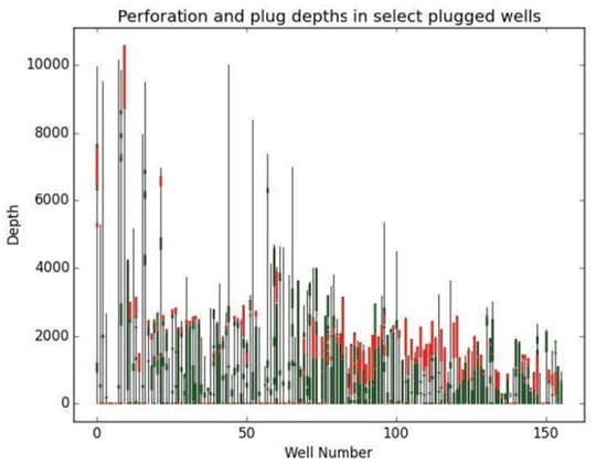
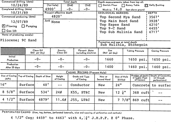
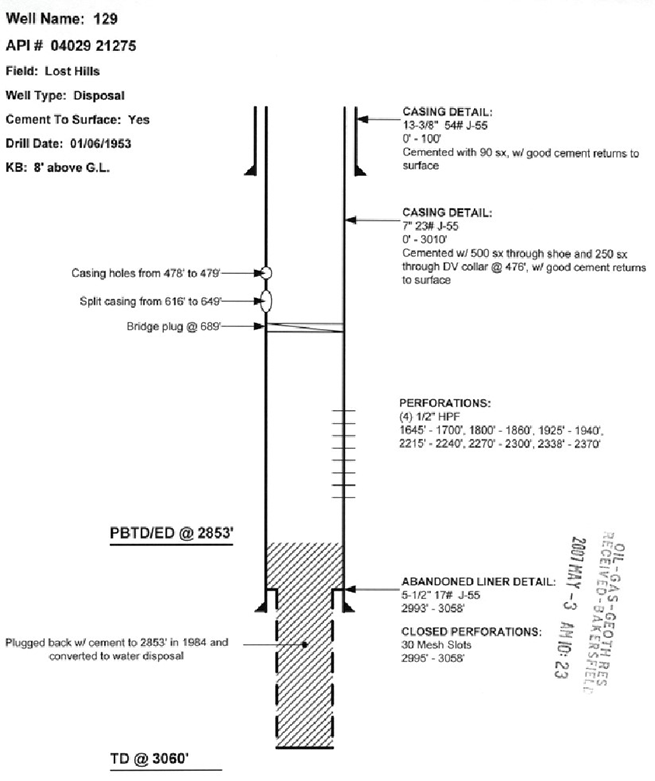
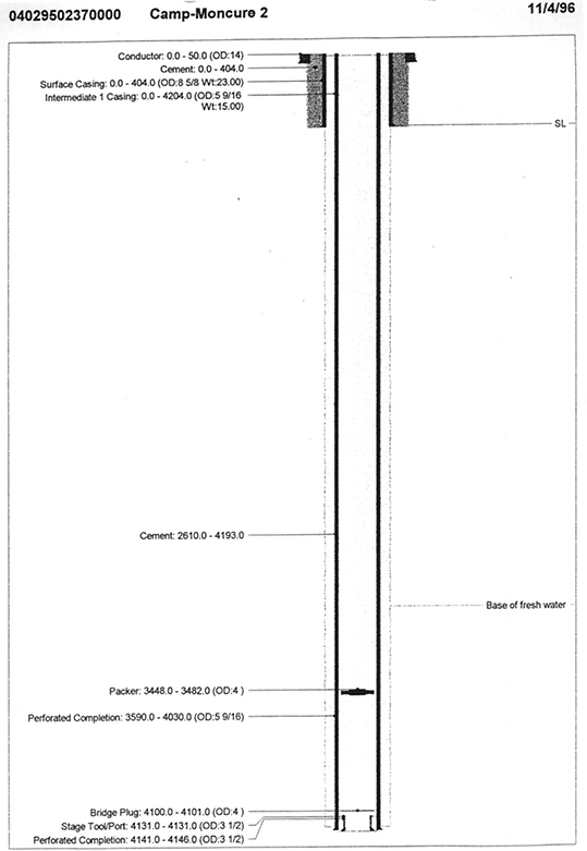
The well records contain detailed information about the drilling process, well construction, and abandonment process. This includes the depths of different kinds of casing cement pumped into the annulus, and perforations.
Records also describe the abandonment process and configuration of what was left in the hole. Typically, this involves multiple cement plugs inside the casing, filling sections with drilling mud, and cutting and capping the pipe below land surface. Before the 1960s, it was not uncommon for operators to pull casing pipe out of the hole, make extensive use of mud and minimal use of concrete, and sometimes insert redwood plugs; while not summarized, many examples of these practices can be found in Summary of Operations annual reports Division of Oil and Gas, 1917-1973. As more modern techniques came into use and more stringent abandonment requirements put in place, the abandonment process shifted towards keeping the casing structure intact and using extensive amounts of cement. In some early cases, exploratory and non-producing oil wells were plugged and transferred as water wells to landowners and water suppliers.
A robust quantitative and spatial description of oil-well construction patterns is not possible without a significant investment in digitizing these records; however, COGG is recording well construction information for oil wells within a 500-meter (1,640-foot) radius from every sampling location.
Geological Data
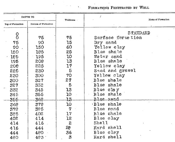
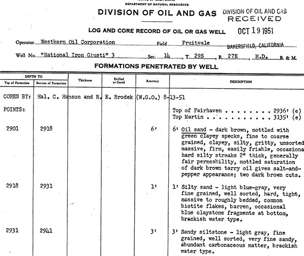
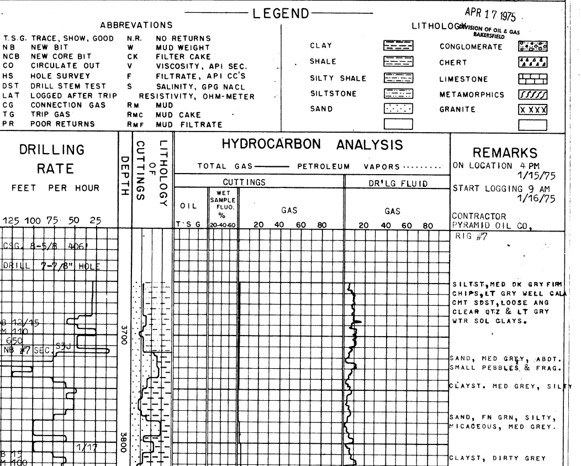
During the drilling process, cores and drill cuttings are collected at intervals and used to identify the depth of different formations and layer structures.
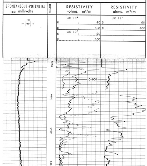
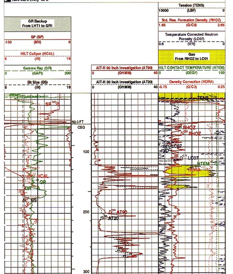
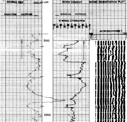
Geophysical Data
Well records also contain geophysical logs run at the time the well was drilled.
Fluid Level/ Pressure Data
The State requires annual inspections of idle wells and information on fluid levels in them. These and other recorded fluid data can be compared to groundwater elevations from the same time frame to determine if there are vertical pressure differences between groundwater aquifers and oil development zones consistent with upward or downward water movement.
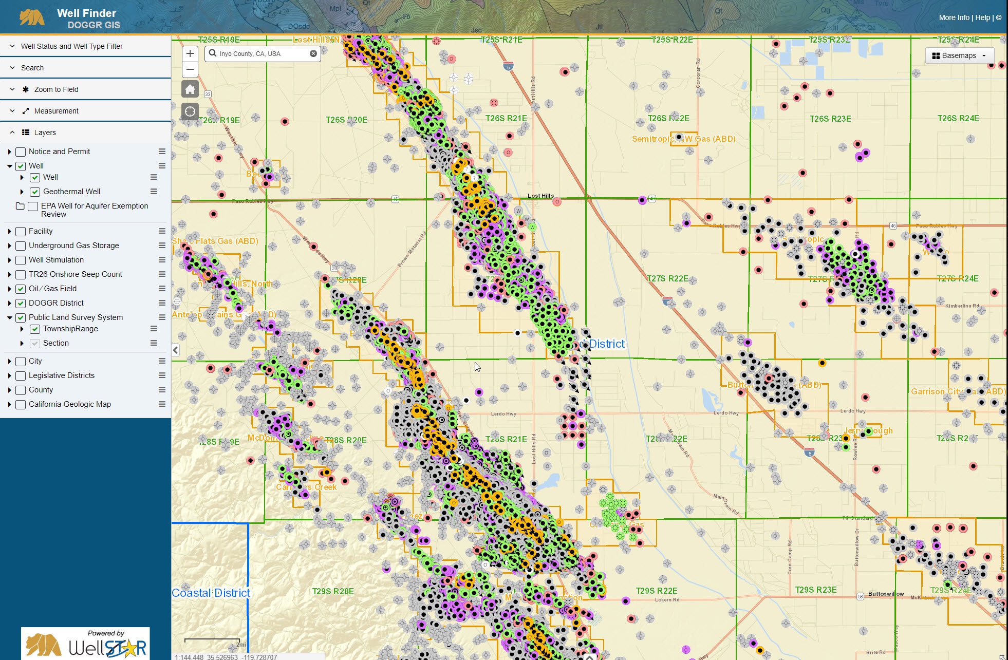
Extracting Information from Well Log Library
The first step in mining information contained in this well record is to create metadata that describes what information is in the well record, such as drilled depth, spud date, and what kind of geophysical logs are in the file.
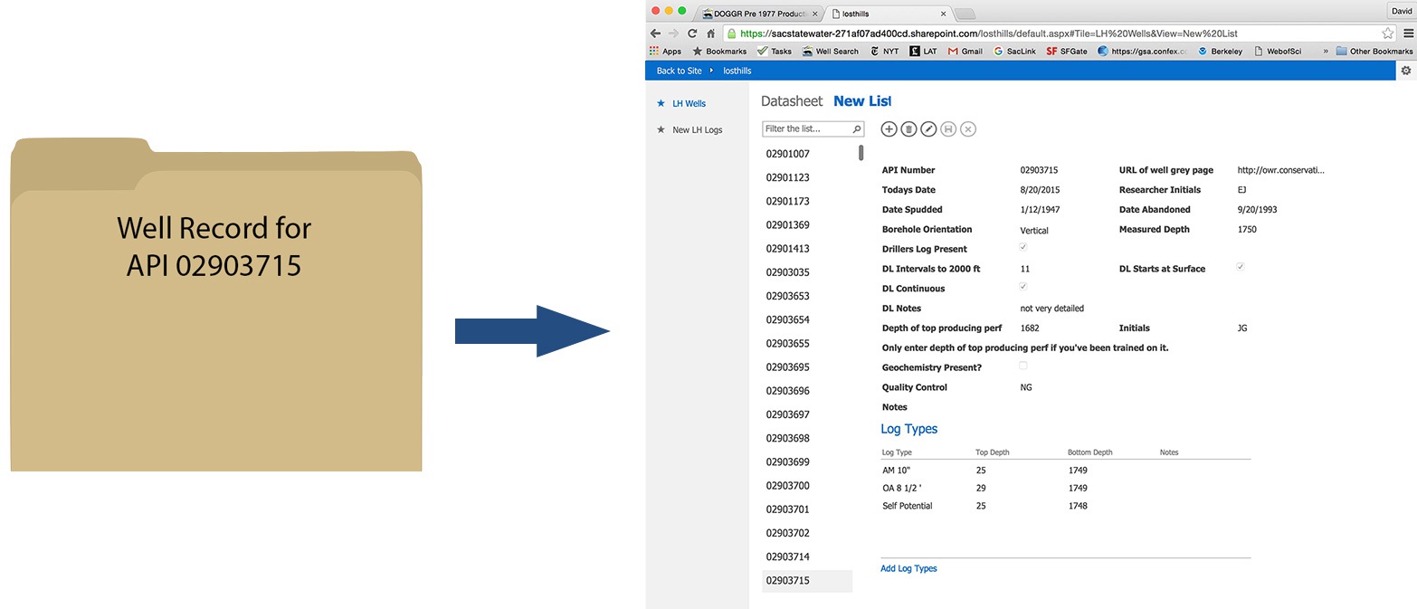
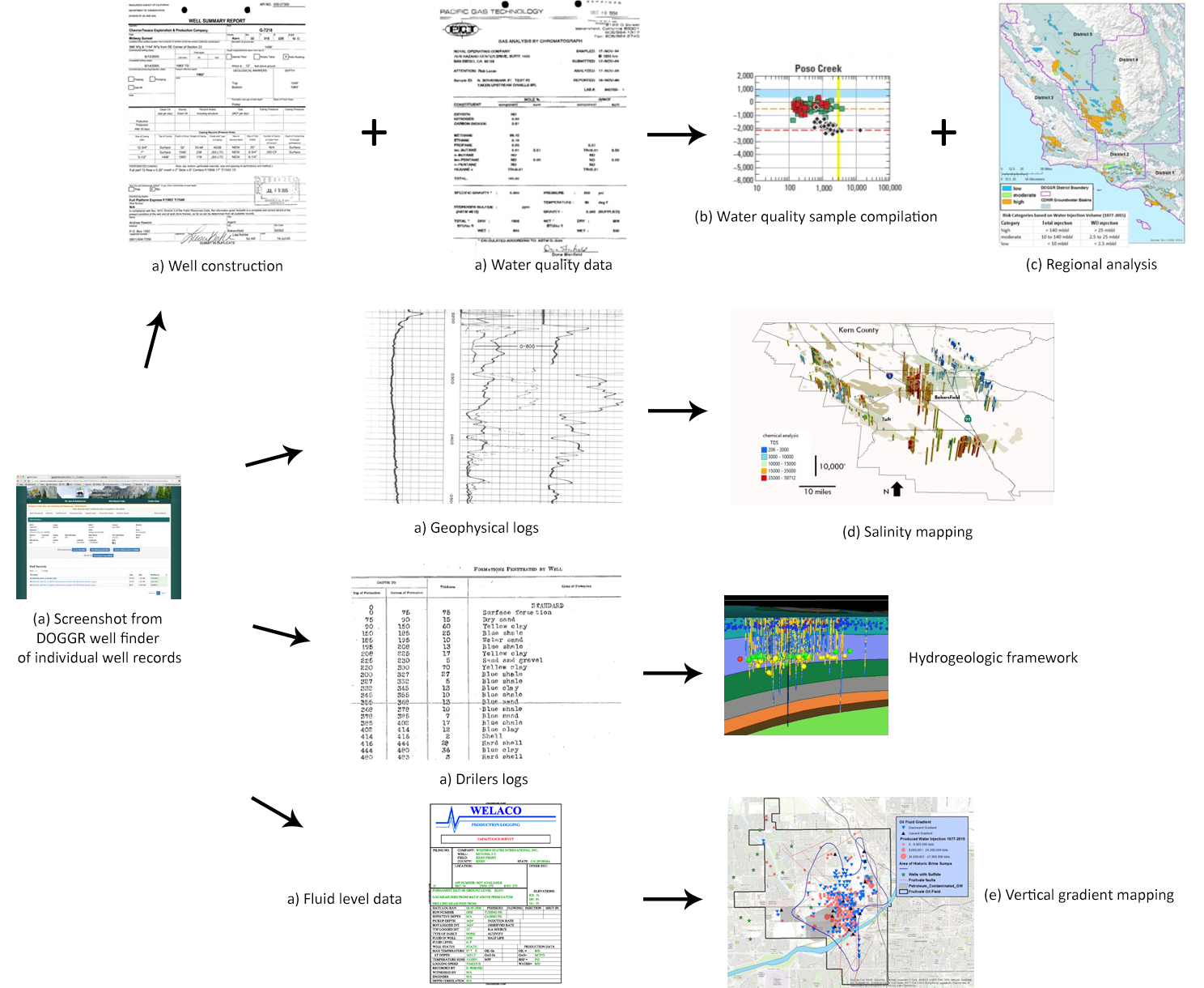
Once the metadata are available, scientists can then identify the specific well records containing additional information for various interpretive tasks as outlined in the graphic below. For example, well construction data and water quality data are used both to create a compilation of water quality information and support regional analyses.
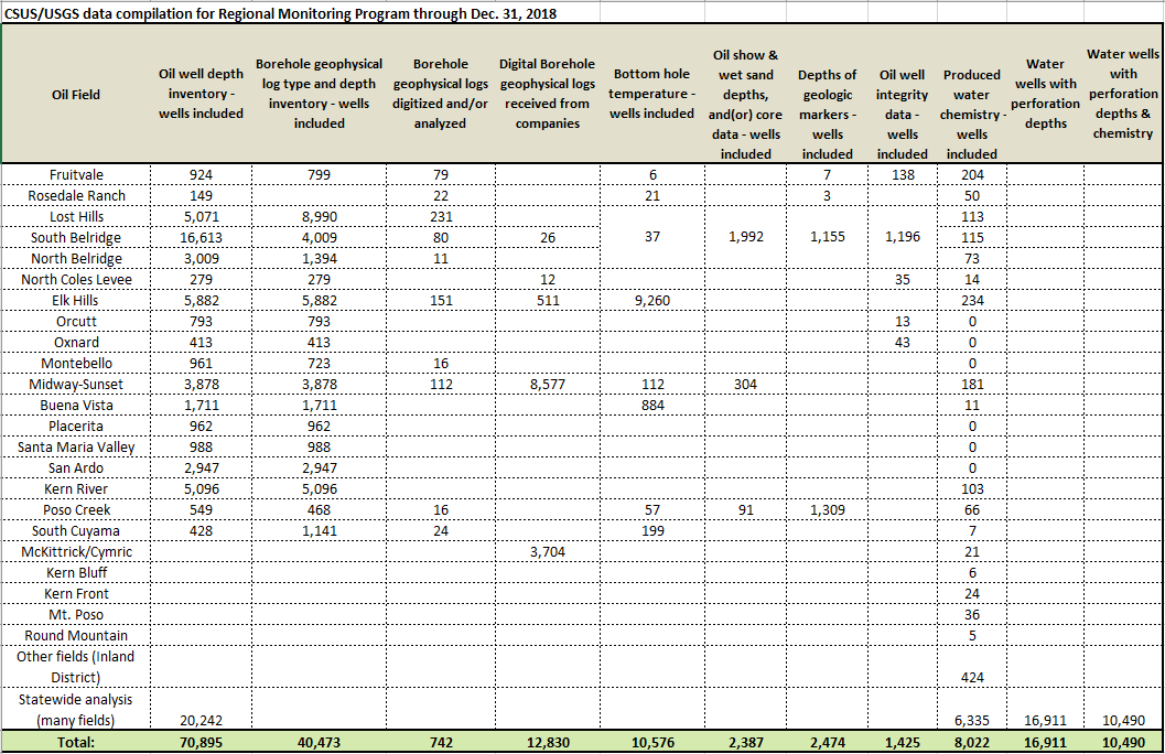
COGG Progress Digitizing Oil Well Records
To date, CSUS and USGS have digitized the following information from the DOGGR well archives: