California Oil, Gas, and Groundwater Program
Cross Section of Fruitvale and Rosedale Ranch Groundwater Salinity
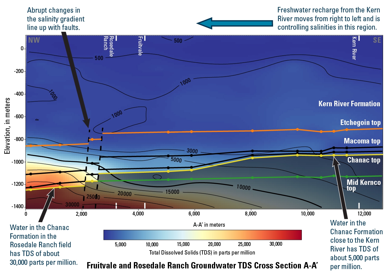
This cross-section was used in this study which modeled subsurface salinity in the vicinity of Fruitvale and Rosedale Ranch oil fields.
Some key findings:
- Thickness and depth of fresh and brackish groundwater varies across these oil fields.
- Salinities vary within the Chanac formation from 5,000 to about 30,000 ppm TDS.
- This variation is systematic.
- Variation is caused by (1) clay layer thickness, (2) distance from a major freshwater recharge source, and (3) faults.
Explore Results
The 3D model from this study can be explored using the button to the right or from the findings web page.
Publication
- Stephens, M.J., Shimabukuro, D.H., Gillespie, J.M., and Chang, W., 2018,
Groundwater Salinity Mapping Using Geophysical Log Analysis Within the Fruitvale and Rosedale Ranch Oil Fields, Kern County, California:
2018 Pacific Section of the American Association of Petroleum Geologists Annual Meeting, Bakersfield, CA, April 22-25, 2018
Data
- Stephens, Michael J., Shimabukuro, David H., Gillespie, Janice M., Metzger, Loren F., Ducart, Ashley, Everett, Rhett, and Gans, Kathleen D., 2018,
Geochemical and geophysical data for wells in the Fruitvale and Rosedale Ranch oil and gas fields:
U.S. Geological Survey data release