California Oil, Gas, and Groundwater Program
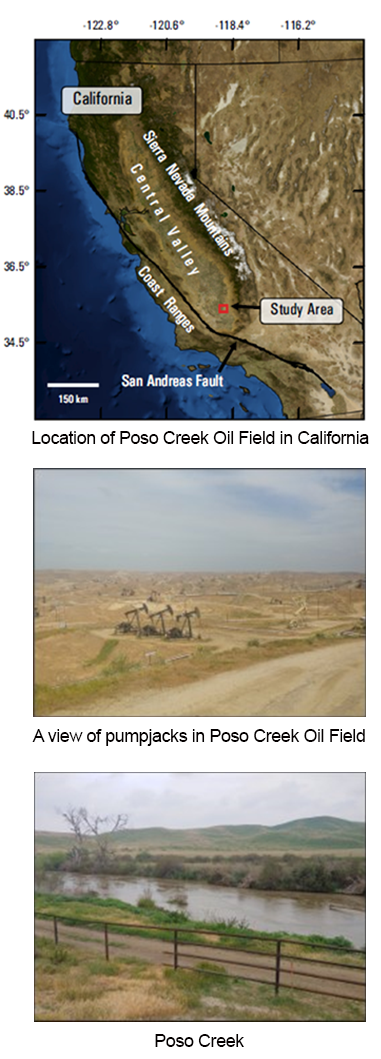
Poso Creek Oil Field
Summary of findings from Stephens and others, 2021
One of the goals of the COGG program is to determine where pathways for fluid migration may exist between oil and gas operations and groundwater aquifers.
Clay formations and faults are generally assumed to be structures that prevent fluid migration in California oil fields, but these geologic features are known to be complex and vary considerably at the oil-field scale.
This web page summarizes the findings of Stephens and others (2021) in a study that used groundwater salinity as a tool for determining where faults and clays seal, and where they allow flow in the Poso Creek Oil Field.
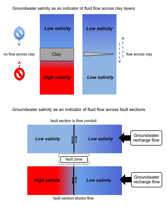
Conceptual Model of Salinity Patterns and Sealing Properties
The first two diagrams explain the basic concepts behind using salinity patterns to investigate sealing properties of clays and faults.
If groundwater flow exists, then salinities are expected to be similar on both sides of the structure.
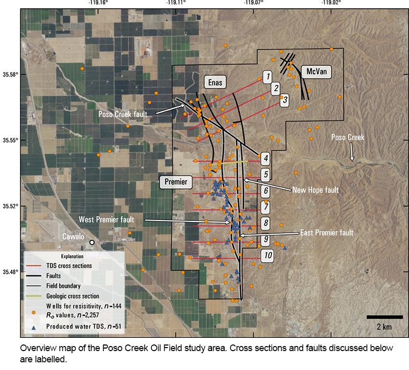
The Poso Creek Oil Field Study Area
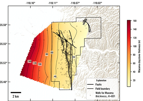
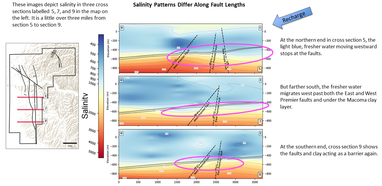
This graphic shows the Macoma clay thickens from east to west. Additionally, the clay is more often a continuous layer in the west but begins to break into lenses in the east.
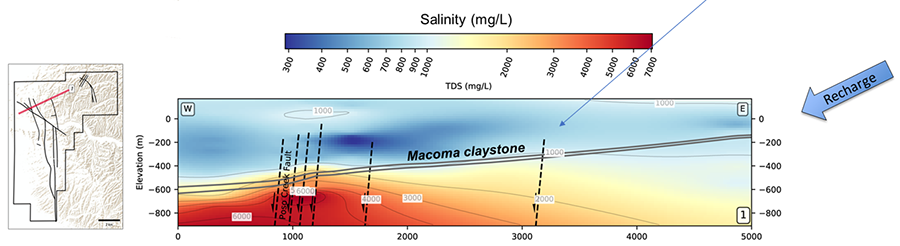
This cross section (red line in the map on left) shows how salinity patterns across the Macoma clay zone shift from east to west. Where the clay is thinnest in the eastern edge, there is not much difference in salinity across the clay. Westward of the fault designated with the blue arrow, there is a clear difference.
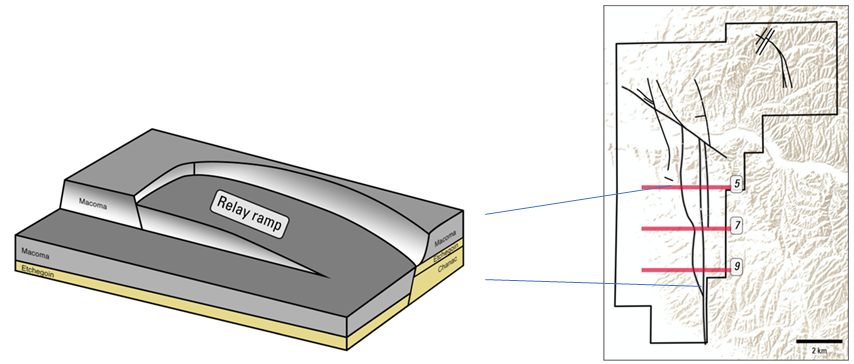
The fault system in the center of the study area corresponds to a relay ramp- type of subsurface structure.
Summary points
- Faults and clay layers may not have the same sealing properties everywhere in an oil field.
- Salinity mapping can be used to explore fluid migration properties in different locations.
- The presence of oil near a fault does not necessarily indicate the fault seals to water flow—in fact, faults can trap oil but be permeable to water.
- Information from multiple wells that are spatially distributed across the study area and geophysical logs that record data all the way from the surface to oil-bearing deposits are the best source of information for these types of field-scale analyses.