California Oil, Gas, and Groundwater Program
3D Maps of Subsurface Salinity in the Montebello Oil Field, Los Angeles County
Summary of findings from Terry and others, 2021.
The COGG program is exploring multiple methods for mapping salinity in the subsurface in the areas overlying and adjacent to active oil fields in California. This study used stochastic statistical estimation methods to classify groundwater salinities into several categories and assign probabilities for that classification.
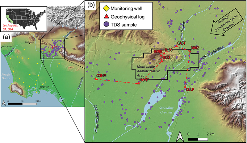
The study focused on the area outlined in black and above the top of the Repetto Formation (as defined in Ponti and others, 2014) which on average was about 560 meters (1,840 feet) below land surface.
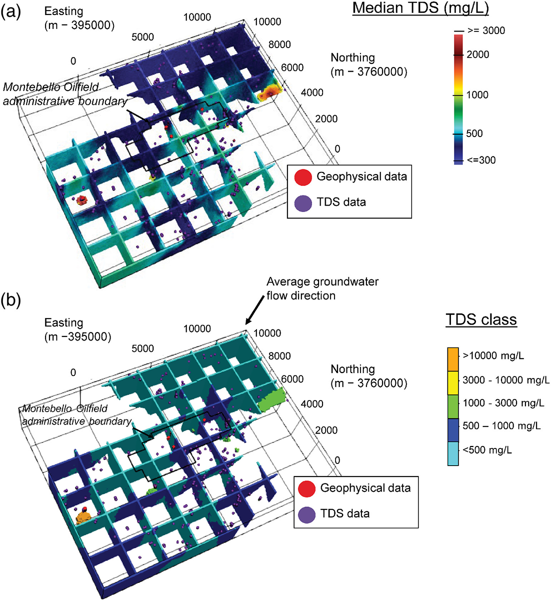
These graphics show that TDS is below 500 mg/L in most of the study area, and there is a trend towards higher TDS values towards the southwest, which is the average regional groundwater flow direction.
There are discrete zones with much higher TDS (for example, the orange zone along the southwest boundary in this figure). This zone is below 250 meters and reflects data from a relatively deep monitoring site (the COMM well on figure 1).
This method honors and propagates the uncertainty inherent in the available data and enables users to combine sparse direct information on salinity with indirect and distributed information. The 3D estimates can be updated to include additional data as they become available.