Integrated Hydrology + Data Science
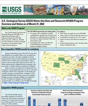
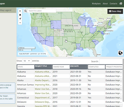
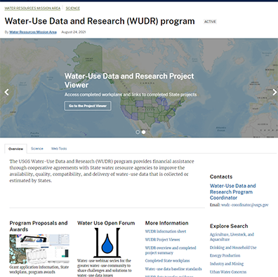
U.S. water managers require more complete, timely, and accurate water withdrawals and consumptive use data. The Water-Use Data and Research (WUDR) Program provides financial assistance through cooperative agreements with State Water Resource Agencies. Workplans are developed by States to evaluate their current water-use data in relation to USGS baseline standards for each category of water user and develop a workplan to improve it. An interactive map viewer is needed to find and view WUDR projects and workplans.
IHDS compiled project information and workplans into an interactive map interface. Projects and workplans can be searched using the map or by using a table of data.
Javascript Development
Visual Design
Web Map Development
Javascript
Leaflet
HTML/CSS
Bootstrap