Integrated Hydrology + Data Science
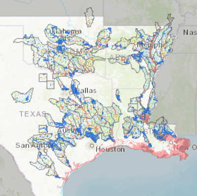
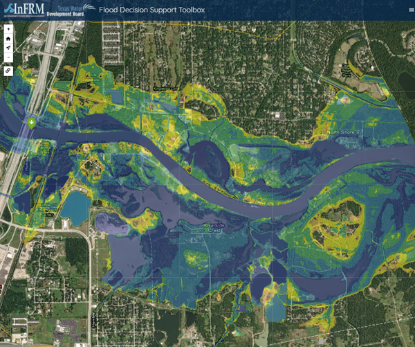
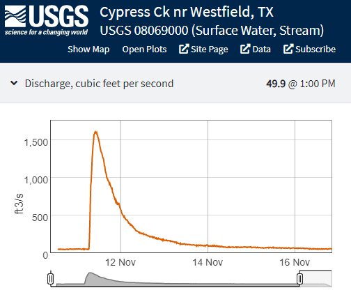
The Interagency Flood Risk Management (InFRM) team brings together Federal Partners to determine the needs of communities and define solutions and implement measures to reduce long term flood risk throughout Arkansas, Louisiana, New Mexico, Oklahoma and Texas. InFRM needed technical expertise to build key parts of the InFRM solution: Estimating Base Flood Elevation, Flood Decision Support Toolbox, and Watershed Hydrology Assessments. Additionally, InFRM needed a website that could provide a single place to find information about the InFRM team and InFRM products.
IHDS scientists and developers have worked cooperatively to build a suite of web applications and reports including
App Development
Data Analysis
Data Integration
Digital Architecture
Geospatial Analysis
Modeling
Web Map Development
ArcGIS Pro
ArcGIS Server
HEC-RAS
Javascript
Leaflet
SQL Server
HTML/CSS
Bootstrap