Integrated Hydrology + Data Science
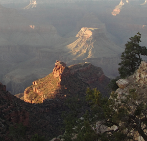
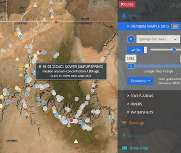
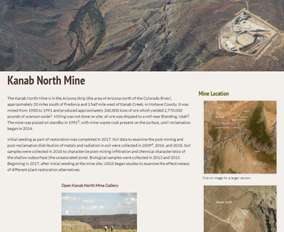
USGS is conducting research at uranium-bearing breccia pipe deposits to address data gaps related to the potential effects of uranium exploration and mining activities on the Grand Canyon watershed, its people, wildlife, and water resources. Study locations are primarily on Federal lands with a few locations on Tribal lands, and include historic and active mines. Study locations and activities are detailed on an expansive USGS web site; however, study personnel need to go through a 3rd party to update the website. Additionally, an interactive water-quality map is needed.
Build a content framework and database to allow study personnel to update content for the site.
Design and develop an interactive map for water-quality data including:
Data Services
Web Development
Visual Design
Web Map Development
Craft
Javascript
Leaflet
Twig
Bootstrap