The USGS completed a multi-year study of water use, availability, and change in the Red River basin in one of several national “Focus Area Studies” in the Department of Interior’s WaterSMART initiative. Focus Area Studies are stakeholder-driven assessments of water availability in river basins with known or potential conflict.
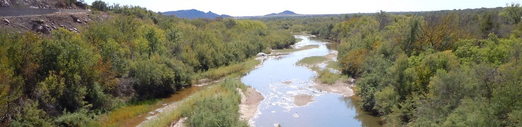
The Red River basin covers more than 93,000 square miles in New Mexico, Texas, Oklahoma, Arkansas, and Louisiana with a population of over 4 million people. Water resources in the basin are being stressed by increasing water demands and increasingly severe droughts. A comprehensive water-resource assessment of the basin was needed to enable sustainable water use.
The Red River Focus Area Study (FAS) compiled existing information and added new scientific data and interpretation to facilitate better management of water resources for use by humans and maintenance of water quality and ecological flows in the basin. The study was organized around three important components [water use, rainfall-runoff model, and ecological flows] that are intended to improve the quality and accessibility of information on water availability for humans and ecosystems in the Red River basin, and to advance technical water assessment capabilities.
The water-use team published a data release for the estimation and compilation of 2010 and 2015 water-withdrawals by drainage basins delineated by 8-digit hydrologic unit codes (HUCs). In addition, the water-use team updated the USGS National Water Information System (NWIS) Aggregate Water-Use Data System (AWUDS) and contributed to the rainfall-runoff model. Contact Natalie Houston for additional information on the Red River FAS water-use study component: [email protected]
Sargent, B.P., Houston, N.A., Heal, E.N., 2020, Estimated Use of Water by Subbasin (HUC8) in the Red River Basin, 2010 and 2015: U.S. Geological Survey data release, https://doi.org/10.5066/P9SQ1Y3T
The rainfall-runoff model team constructed a daily time-step Precipitation Runoff Modeling System (PRMS) of streamflow for all the Red River Basin. The Red River FAS PRMS model was built upon the existing Gulf Coastal Plains and Ozarks (GCPO) Landscape Conservation Cooperative (LCC) model and incorporated current climate, water use, and dynamic land use data. Contact Victor Roland for additional information on the Red River FAS rainfall-runoff model study component: [email protected]
Roland, V.L., II, 2023, Application of the Precipitation-Runoff Modeling System (PRMS) to simulate the streamflows and water balance of the Red River Basin, 1980-2016: U.S. Geological Survey Scientific Investigations Report 2022-5105, 37 p., https://doi.org/10.3133/sir20225105
Roland, V.L. II, 2023, Model input and output from Precipitation Runoff Modeling System (PRMS) simulation of the Red River basin 1981-2016: U.S. Geological Survey data release, https://doi.org/10.5066/P9ZI5IVX
The ecological flows team summarized available fish community data for portions of the Red River basin in Oklahoma and Texas and used the modeled streamflow data to link flow alterations to changes in the fish assemblage over time. Contact Shannon Brewer for additional information on the Red River FAS ecological flows study component: [email protected]
Mollenhauer, R., Mouser, J.B., Roland, V.L., and Brewer, S.K., 2022, Increased landscape disturbance and streamflow variability threaten fish biodiversity in the Red River catchment, USA: Diversity and Distributions, https://doi.org/10.1111/ddi.13595