
Sierra Nevada Region Groundwater Resources Used for Public Supply
Study Unit
- Study Area: Sierra Regional
- Counties Covered: Lassen, Plumas, Butte, Sierra, Yuba, Nevada, Placer, El Dorado, Sacramento, Amador, Alpine, Calaveras, Tuolumne, Mono, Mariposa, Madera, Fresno, Inyo, Tulare, and Kern
Click on the study area below to see a list of products.
Products
Reports
Groundwater Quality in the Sierra Nevada, California
Fram, M.S., and Belitz, K., 2014, U.S. Geological Survey Fact Sheet 2014-3096, 4 p.
Groundwater Quality in the Southern Sierra Nevada, California
Fram, M.S., and Belitz, K., 2012, U.S. Geological Survey Fact Sheet 2012-3011, 4 p.
Status and Understanding of Groundwater Quality in the Sierra Nevada Regional Study Unit, 2008: California GAMA Priority Basin Project
Fram, M.S., and Belitz, K., 2014, U.S. Geological Survey Scientific Investigations Report 2014-5174, 118 p.
Data
Blank results for trace-element data collected for the California Groundwater Ambient Monitoring and Assessment (GAMA) Program Priority Basin Project, October 2009-October 2018
Bennett, G.L., 2020, U.S. Geological Survey data release
Ground-water quality data in the Southern Sierra study unit, 2006: Results from the California GAMA program
Fram, M.S. and Belitz, K., 2007, U.S. Geological Survey Data Series 301
Groundwater-quality data for the Sierra Nevada study unit, 2008: Results from the California GAMA program
Shelton, J.L., Fram, M.S., Munday, C.M., and Belitz, K., 2010, U.S. Geological Survey Data Series 534, 82 p.
Pesticide Constituent Data from the California Groundwater Ambient Monitoring and Assessment Program Priority Basin Project (GAMA-PBP), 2004 - 2018
Lor, V., Balkan, M., and Stork, S.V., 2019, U.S. Geological Survey data release
Water use information for sites sampled by the California Groundwater Ambient Monitoring and Assessment Program Priority Basin Project (GAMA-PBP), 2004-2021 (ver. 3.0, October 2023)
Stork, S.V., and Fram, M.S., 2021, U.S. Geological Survey data release
Photos
Click on a photo to see the full-size image.
View of Glass Creek flow from Highway 395 looking toward the west; the crest of the Sierra Nevada towers above.
Credit: D.Y. Venezky, USGS, 2009
View of Glass Creek flow from Highway 395 looking toward the west; the crest of the Sierra Nevada towers above.
Photo Credit: D.Y. Venezky, USGS
Date Taken: 9/17/2009
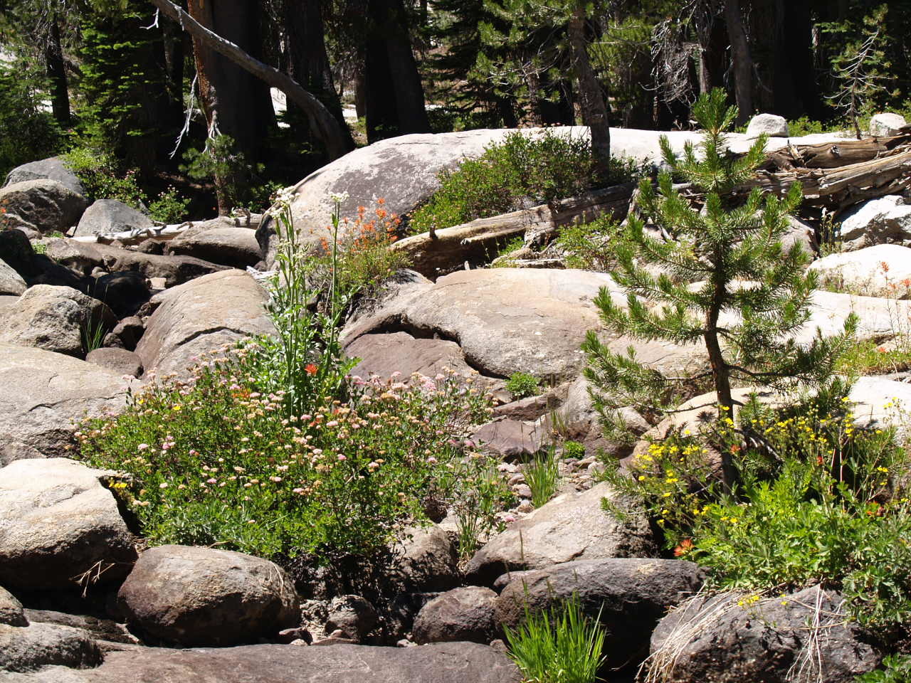
Weathered granite in Sierra forest
Credit: Kim Taylor, USGS, 2007
Weathered granite in Sierra forest
Photo Credit: Kim Taylor, USGS
Date Taken: 7/20/2007
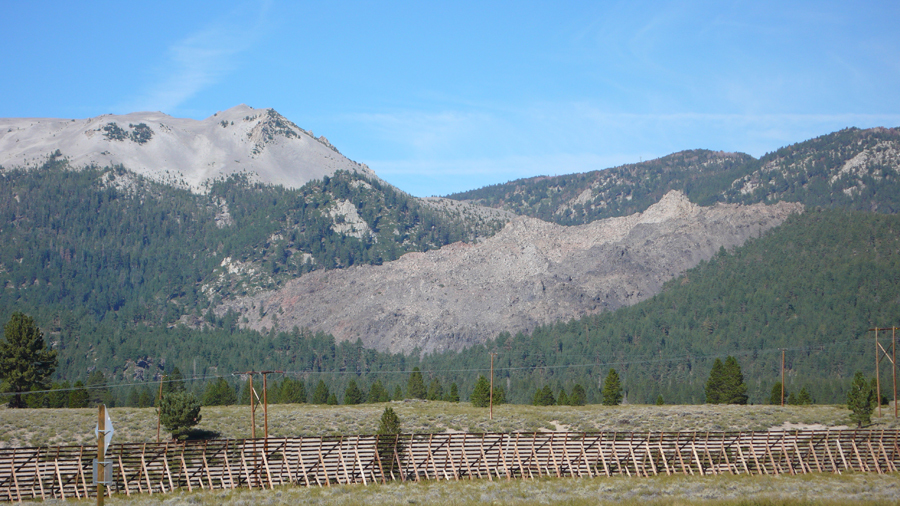
A 3-4 m high outcrop of basalt lava, part of a broader lava flow that erupted about 300,000 years ago following basalt dike intrusions in a rear-arc region of northern California
Credit: Duane Champion, USGS, 2016
A 3-4 m high outcrop of basalt lava, part of a broader lava flow that erupted about 300,000 years ago following basalt dike intrusions in a rear-arc region of northern California
Photo Credit: Duane Champion, USGS
Date Taken: 9/2/2016
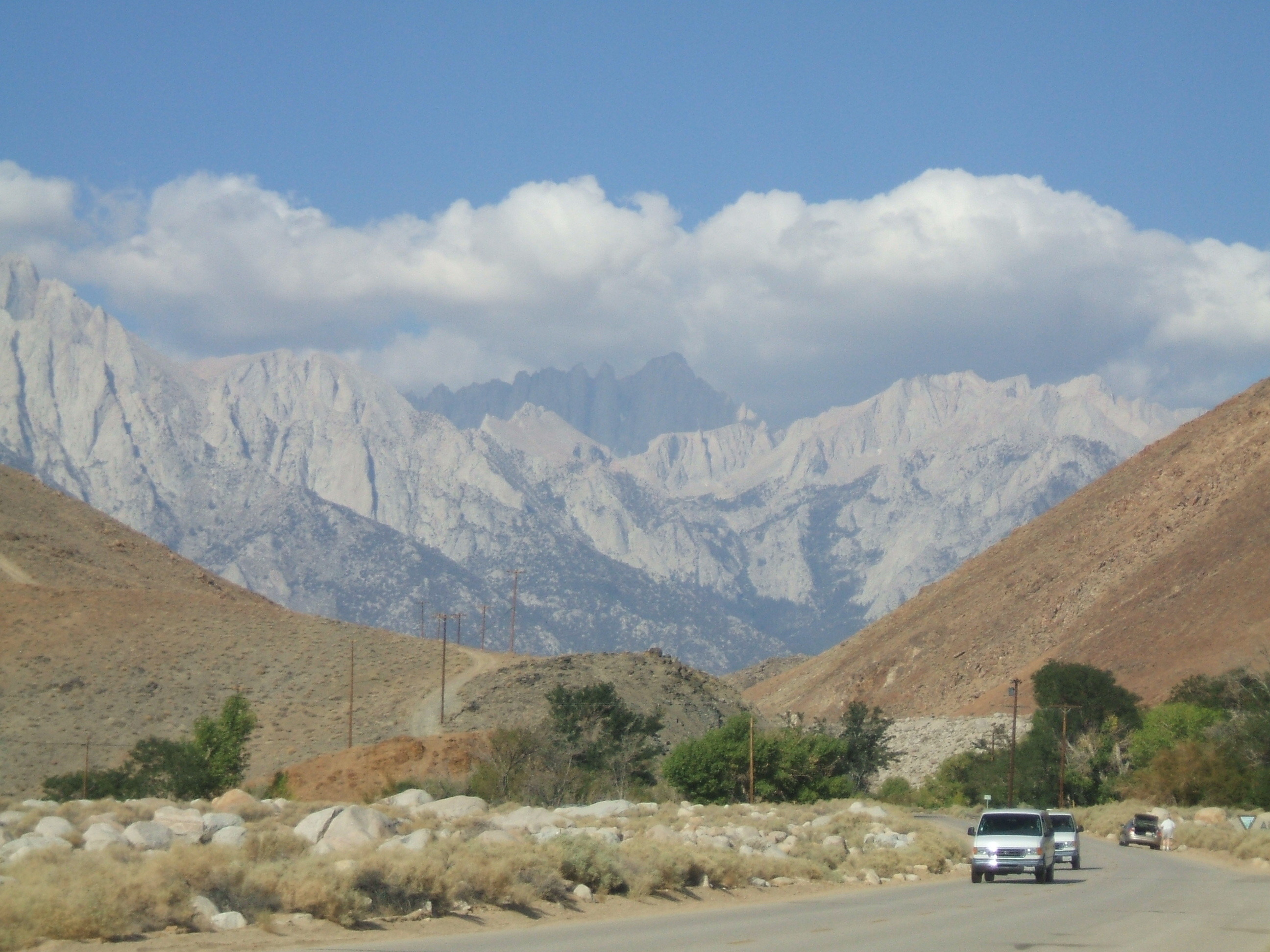
View up valley near Mt Whitney
Credit: USGS, 2006
View up valley near Mt Whitney
Photo Credit: USGS
Date Taken: 9/14/2006
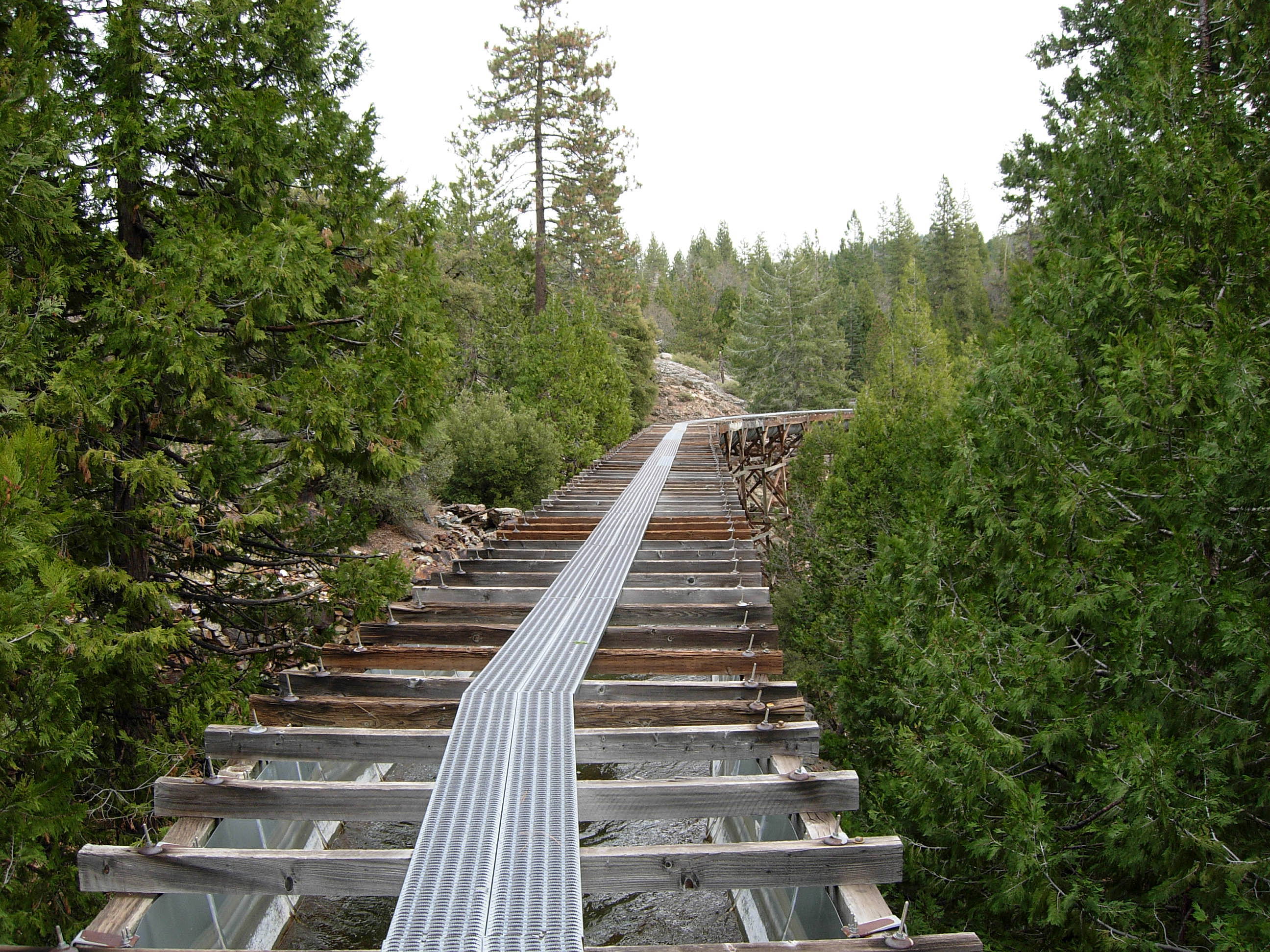
Elevated water canal in Nevada County, California
Credit: Kim Taylor, USGS, 2007
Elevated water canal in Nevada County, California
Photo Credit: Kim Taylor, USGS
Date Taken: 11/25/2007
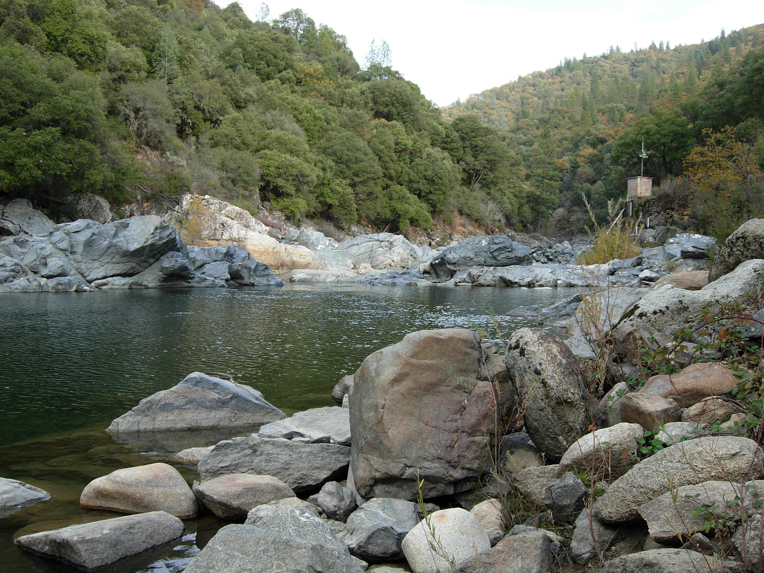
Upstream view at Jones Bar, South Yuba River, Nevada County, California
Credit: Kim Taylor, USGS, 2007
Upstream view at Jones Bar, South Yuba River, Nevada County, California
Photo Credit: Kim Taylor, USGS
Date Taken: 11/8/2007