Recent Studies
Areas listed below have been studied recently by the GAMA program.
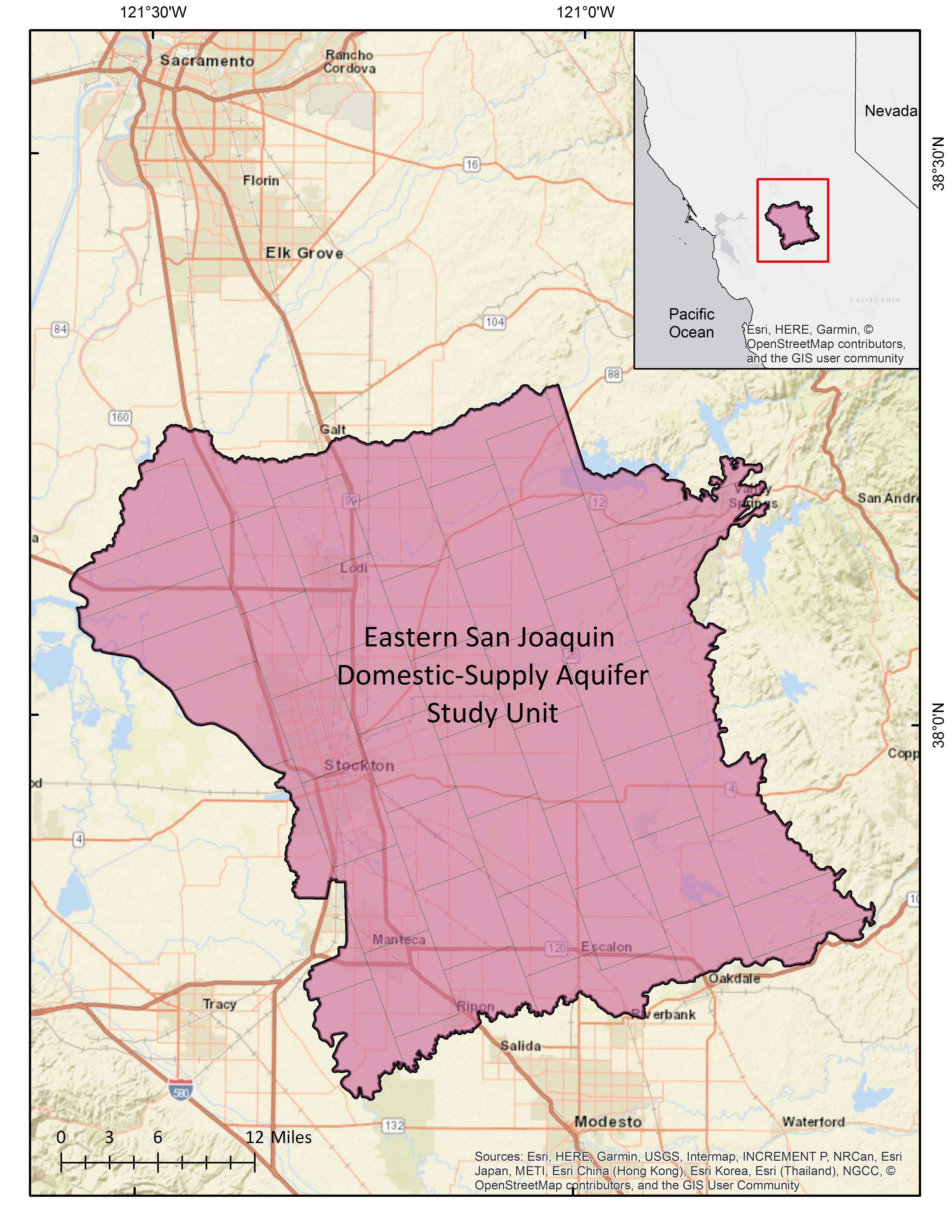
Groundwater resources used for domestic supply studies are in green.
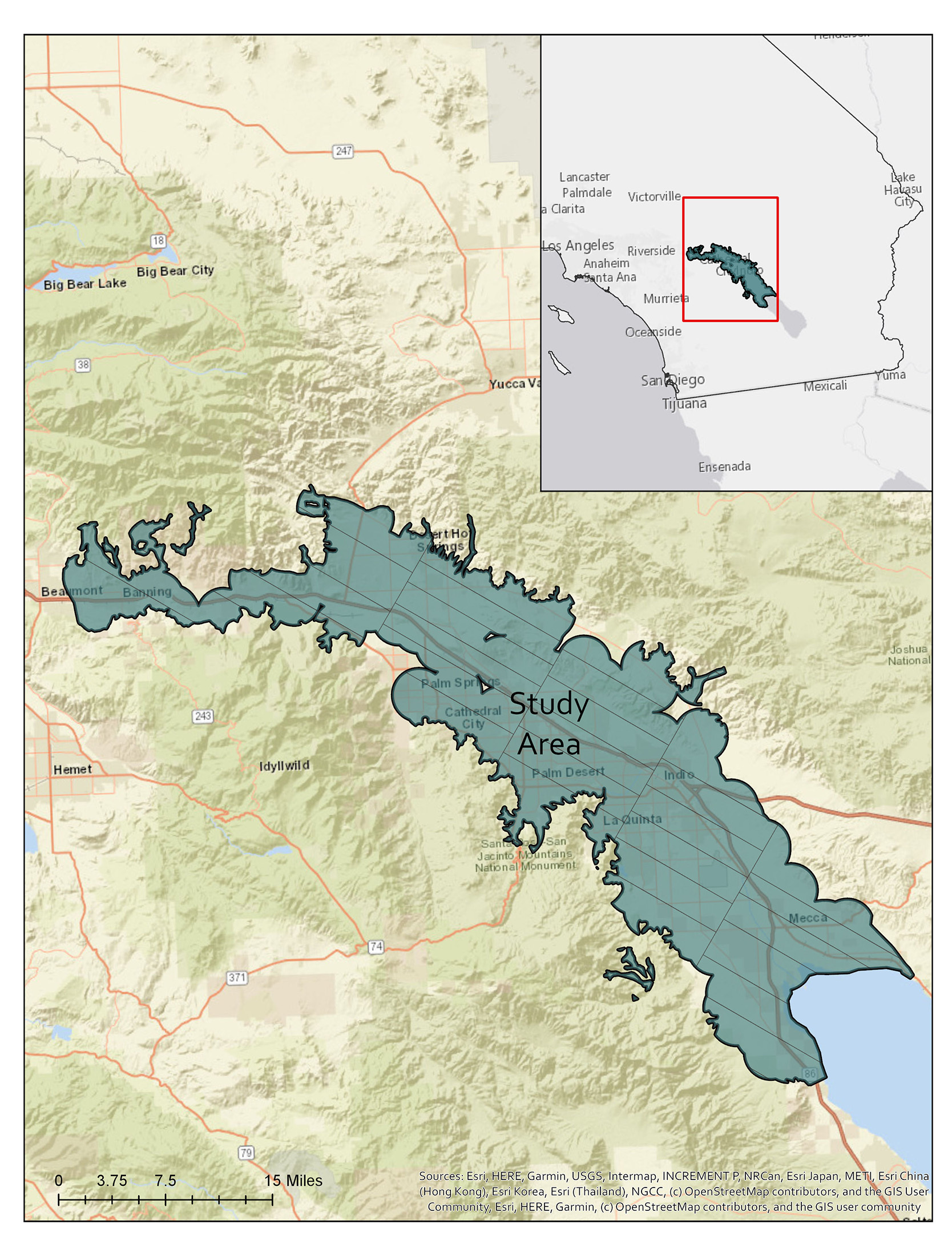
Groundwater resources used for public supply studies are in blue.
Central Sierra Nevada
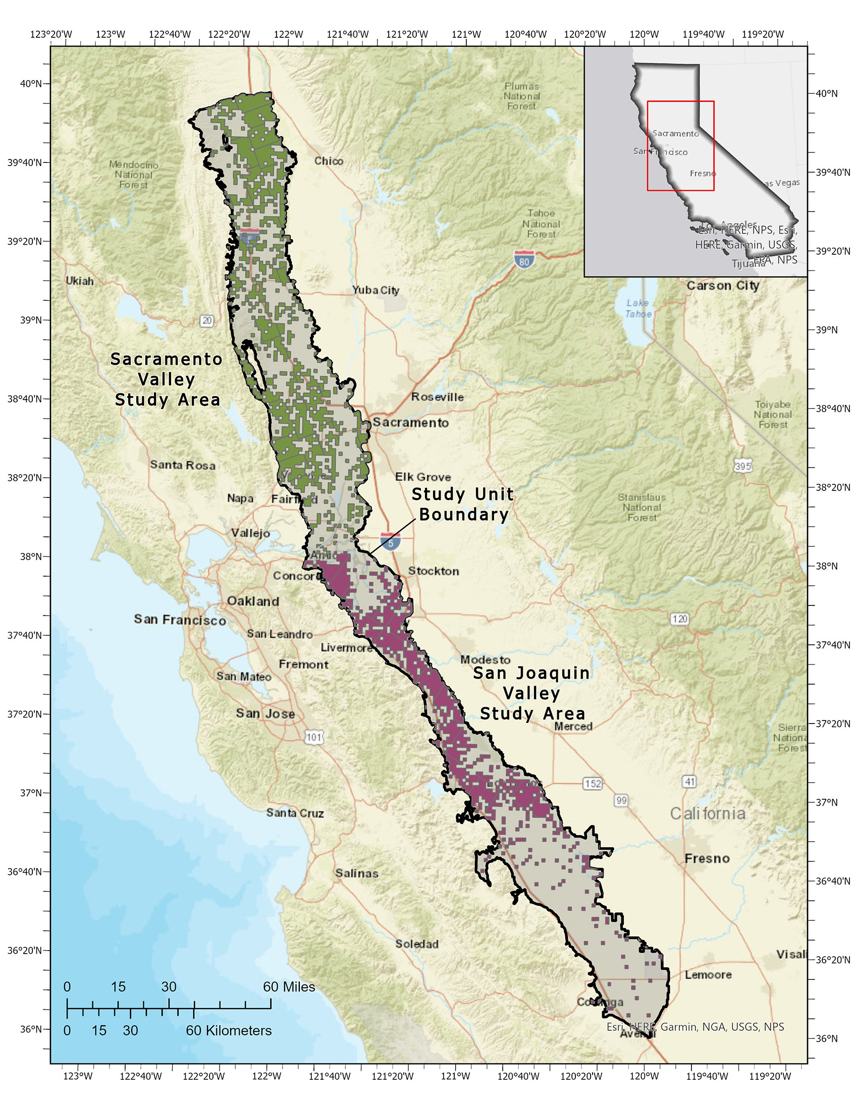
Western Central Valley
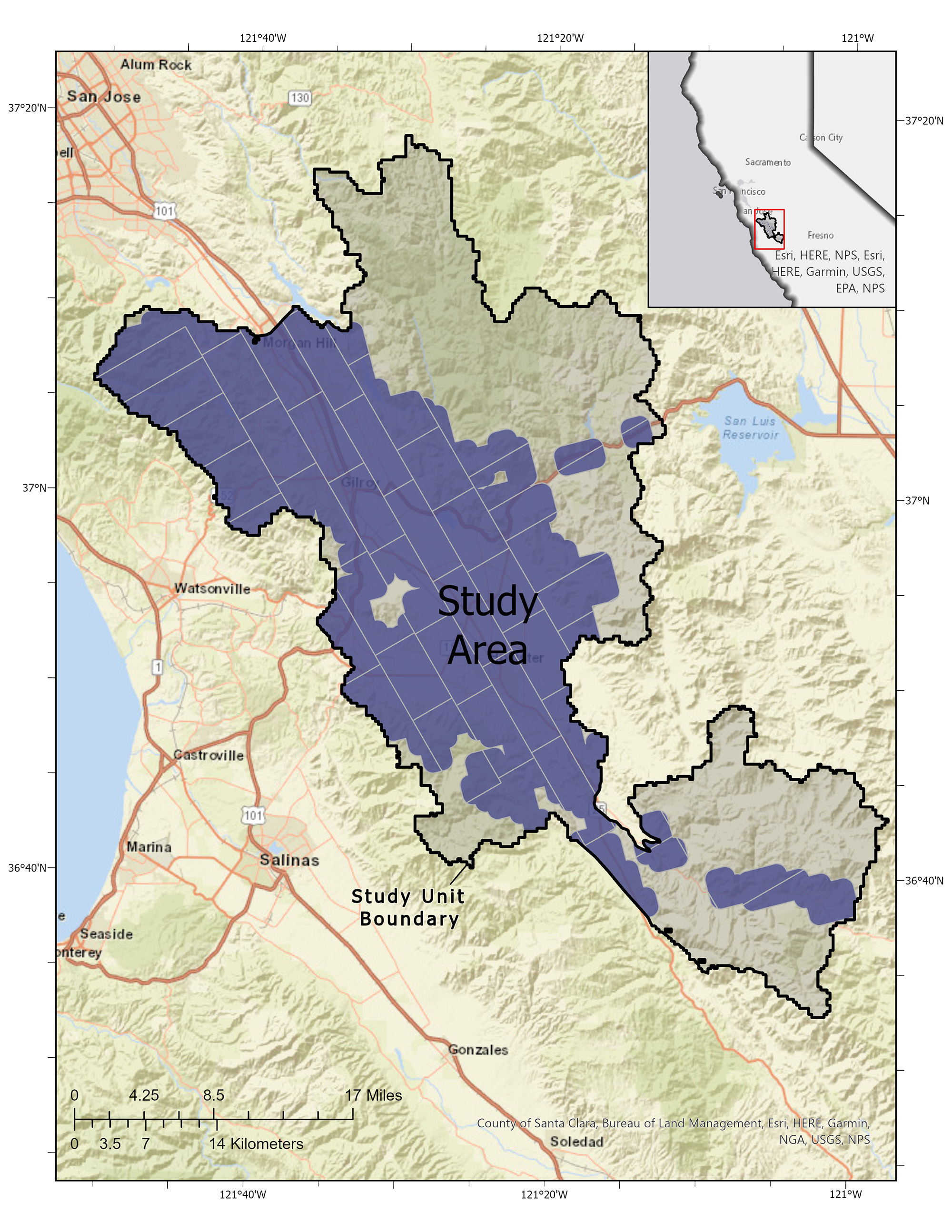
Gilroy-Hollister Basin & Surrounding Areas
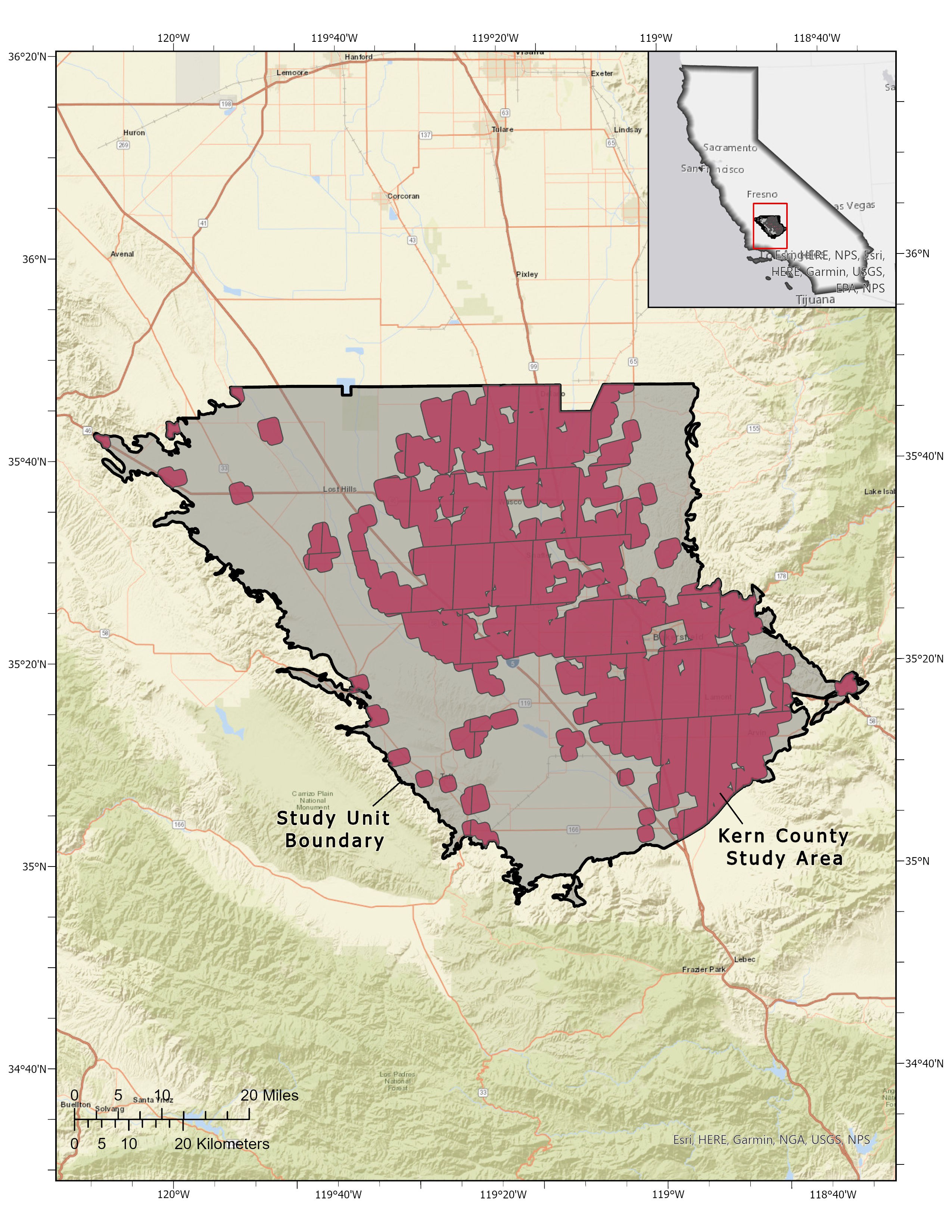
Kern County
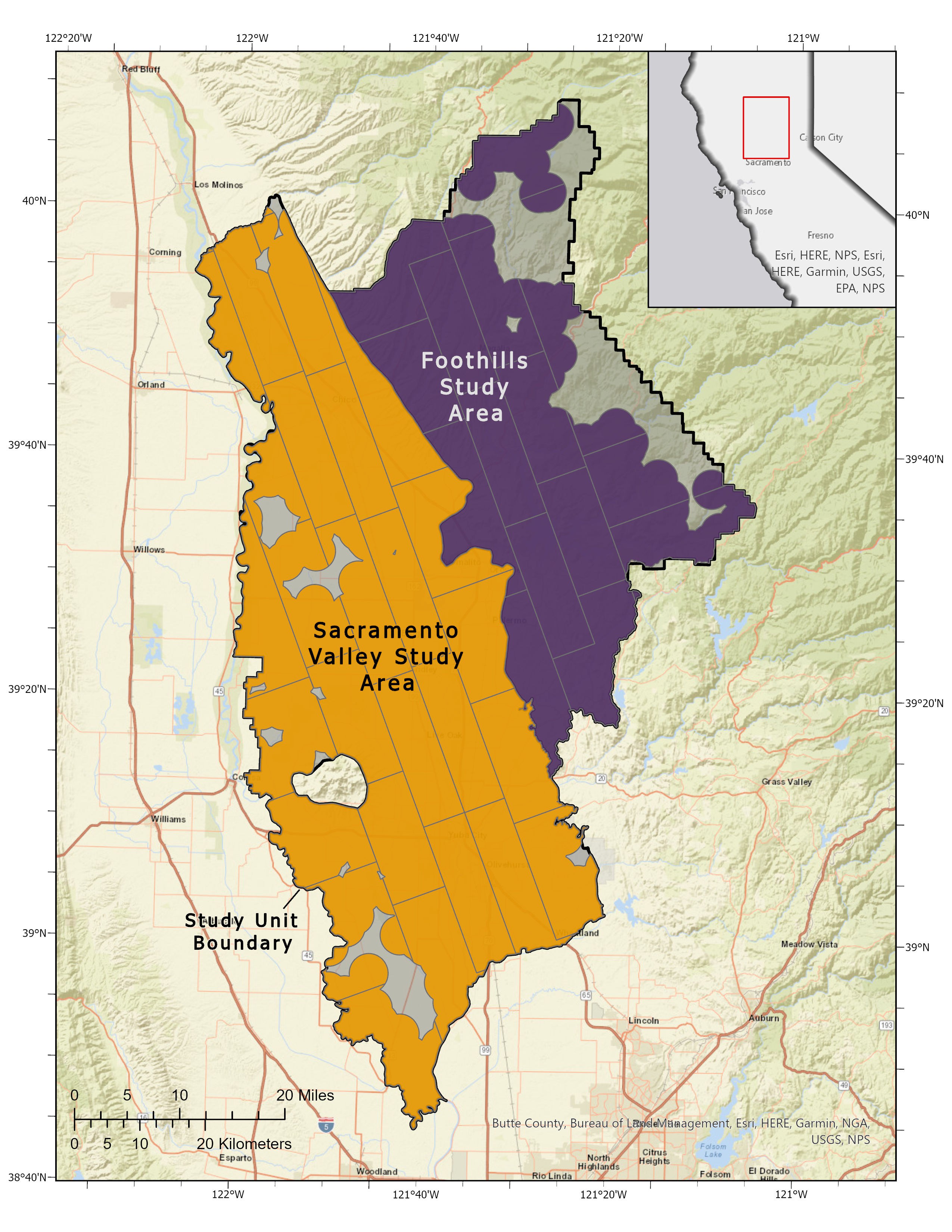
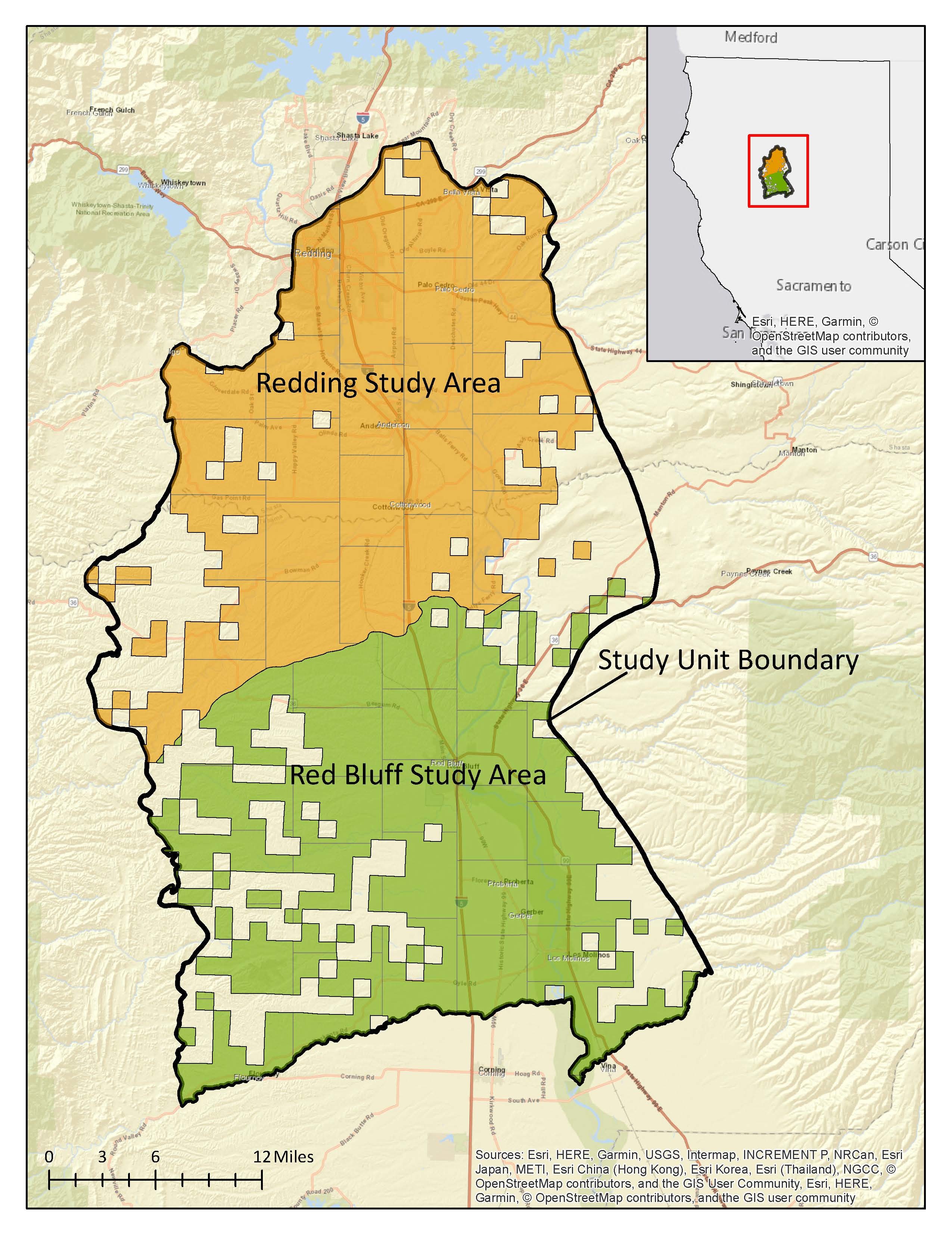
Eastern Sacramento Valley and Foothills
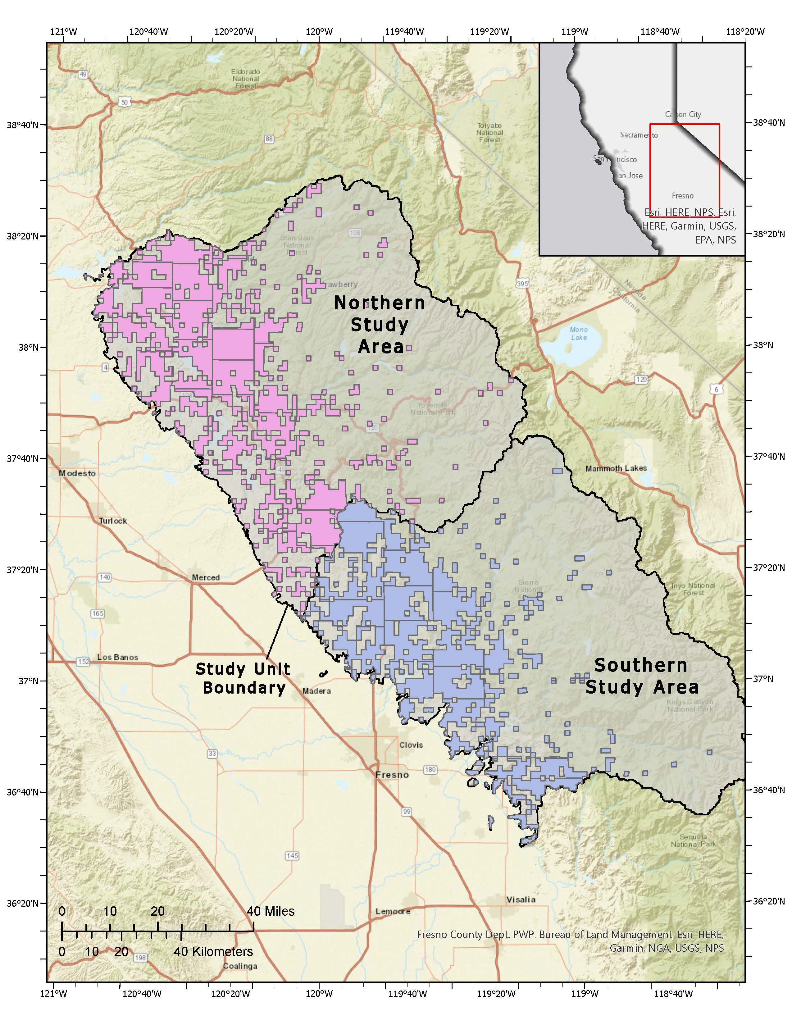
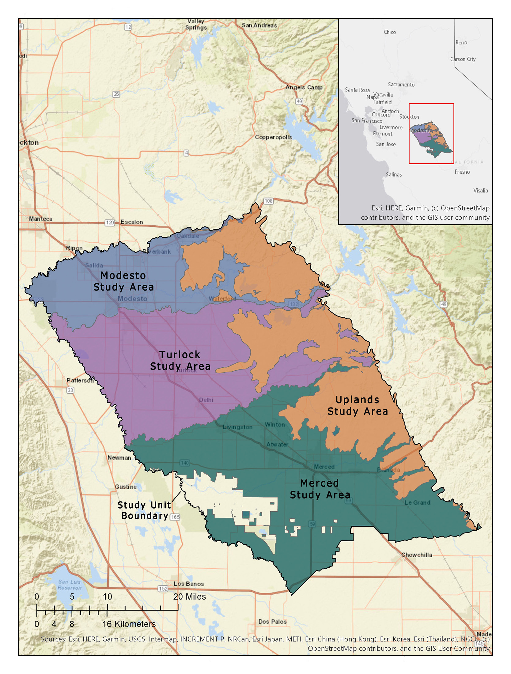
Central San Joaquin Valley
Coachella Valley Area
E. San Joaquin Area
N. Sacramento Valley
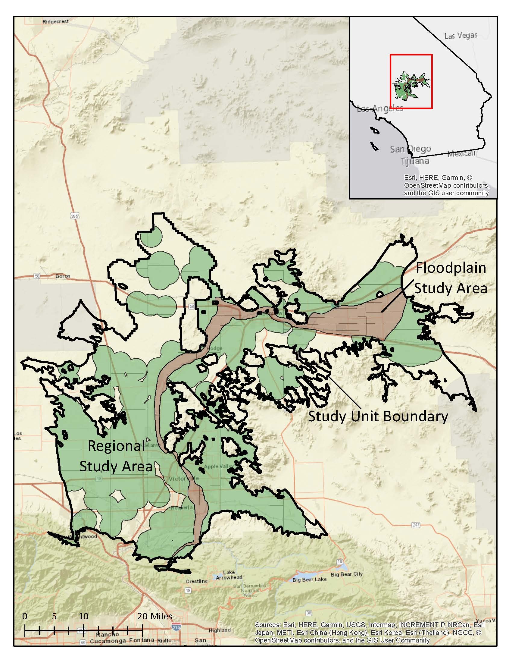
Mojave